GEORGIA
Rank: No. 2
Nuclear Warheads: 2000
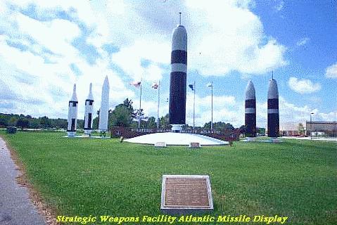
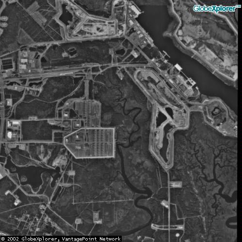
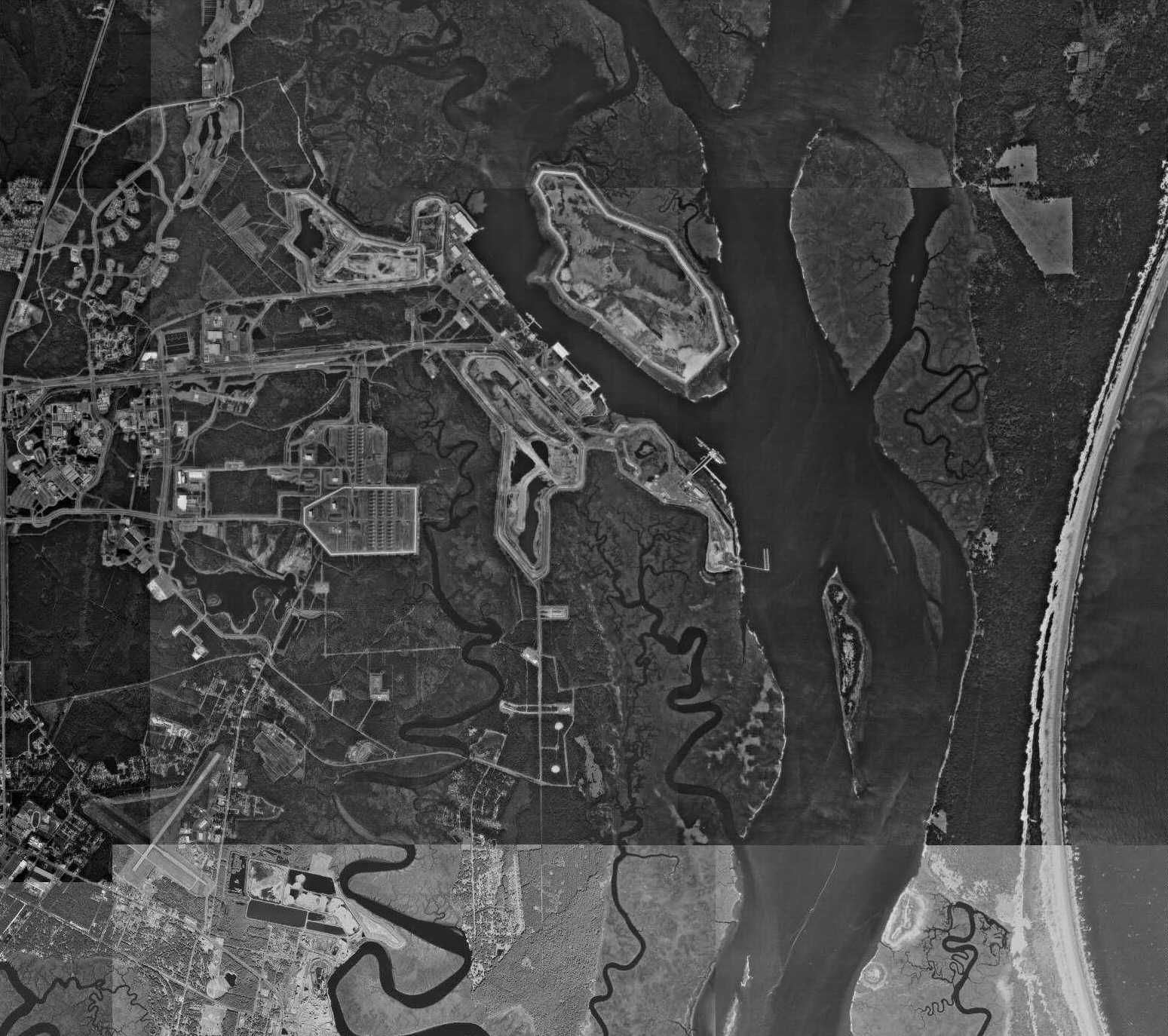
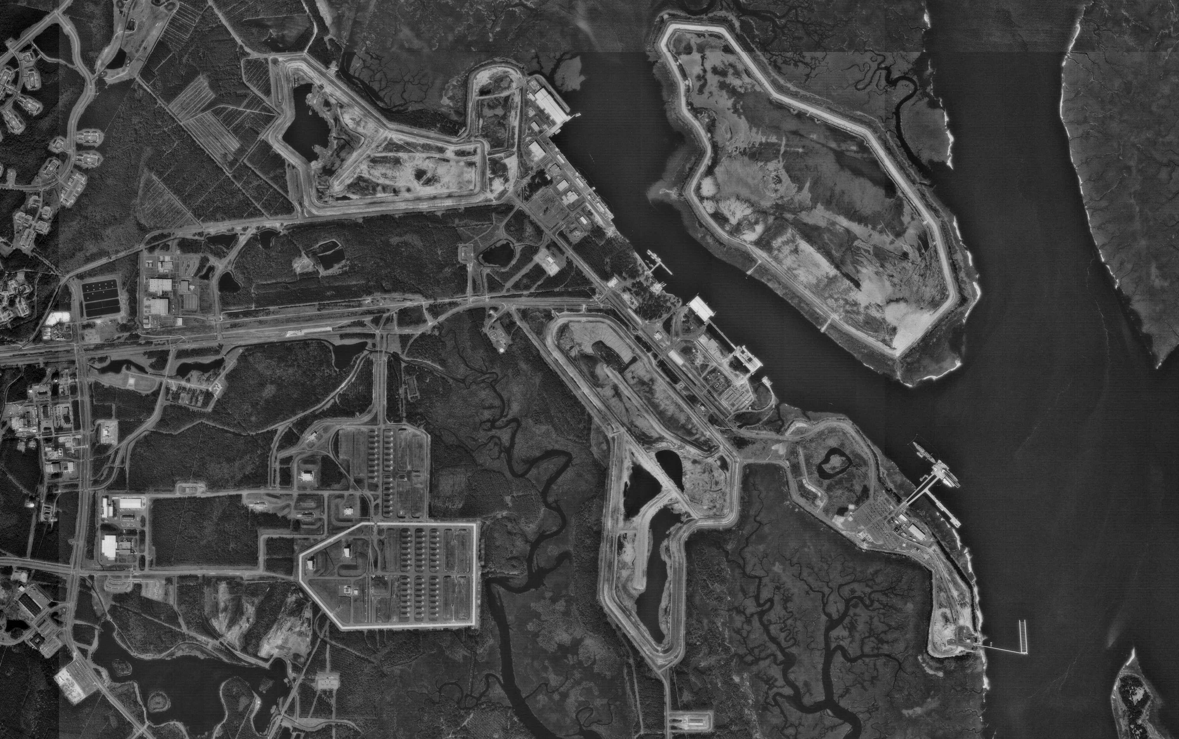
Kings Bay
NAVAL SUBMARINE BASE
GEORGIA ranks 2nd in number of nuclear warheads deployed, a rise from 11th
place in 1992, and 12th place in 1985. The Naval Submarine Base Kings Bay
is the homeport for the Navy’s Atlantic-based Trident II-equipped (Ohio
class) ballistic missile submarine force subordinate to the Submarine Forces
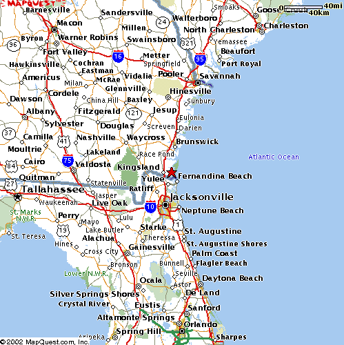
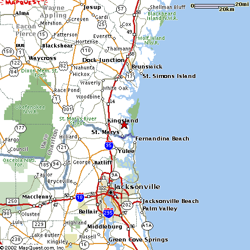
Atlantic Fleet (SUBLANT). The base is just north of the Florida-Georgia border,
about 40 miles north of Jacksonville, Florida.
The W88 and W76 warheads for the ten assigned submarines are nominally
“stored” at the base, even though half of those submarines are
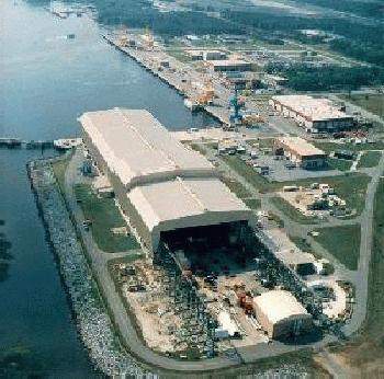
at sea (or in overhaul) at any one time. The Strategic Weapons Facility Atlantic
(SWFLANT) is responsible for storage, handling, and maintenance of nuclear
weapons at Kings Bay. Because the number of W88 Trident II warheads manufactured
was not sufficient to arm all ten of the Trident II capable submarines, W76
Trident I warheads from retired Atlantic fleet Poseidon submarines also arm
the force.
The Army began to acquire land at Kings Bay in 1954 on which it planned to
build a military ocean terminal which would be used to ship ammunition in
event of a national emergency. Construction began in 1956 and was completed
two years later at a cost of $11 million. The most prominent feature of the
terminal was a 2000 footlong, 87 foot-wide concrete and steel wharf, with
three parallel railroad tracks, enabling simultaneous loading of several
ammunition ships. A 10 mile-long, 200 foot-wide channel, dredged by the Army
to 32 feet provided access between the bay and the ocean via the St. Marys
channel. Elsewhere the Army built 47 miles of railroad track. The base was
never activated.
In 1975 there were negotiations between the U.S. and Spain over the continued
basing of ballistic missile submarines at Rota, Spain. The resulting 1976
treaty called for withdrawal of the Navy squadron by July 1979. Some sixty
sites along the Atlantic and Gulf coasts were evaluated as a replacement
and by the summer of 1976 the number was reduced to five: Narragansett Bay,
RI; Cheatham Annex, VA; Charleston, SC; Mosquito Lagoon, FL; and Kings Bay,
GA. Kings Bay was chosen to be the support base for Squadron Sixteen in November
1976, with initial homeporting of the submarines and crews in Charleston,
SC. The relocation occured in July 1979 with a submarine tender (USS Canopus,
AS-34), a floating dry dock (USS Oak Ridge, ARDM-1), and eight SSBNs. This
modest four year effort cost $125 million.
In May 1979 Kings Bay was selected as the permanent east coast Trident homeport,
refit site, and training base for Ohio-class SSBNs. This major decade-long
effort cost several billion dollars. On March 29, 1990 the Navy declared
the USS Tennessee (SSBN 734) operational as it went on its first patrol from
Kings Bay, carrying Trident II SLBMs. On September 6, 1997 the 18th and last
Ohio-class submarine (the USS Louisiana) was commissioned, the tenth
to be based at Kings Bay.


