
| Donate $25 for two DVDs of the Cryptome collection of files from 1996 to the present |
|
20 August 2009. Add birdseye of Harris NPS, NC.
10 February 2008. Add aerials of Calvert Cliffs NPP, MD and aerial and birdseye of Crystal River NPP, FL.
23 November 2007
Add Local Live birdseye of Turkey Point Nuclear Power Plant:
http://eyeball-series.org/turkey/turkey-birdseye.htm
11 November 2007
Add Google and/or Mapquest color aerials of:
Arkansas Nuclear One, AR
Beaver Valley Nuclear Power Station, PA
Browns Ferry Nuclear Power Plant, AL
Byron Generating Station, IL
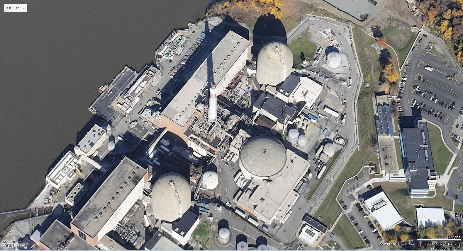
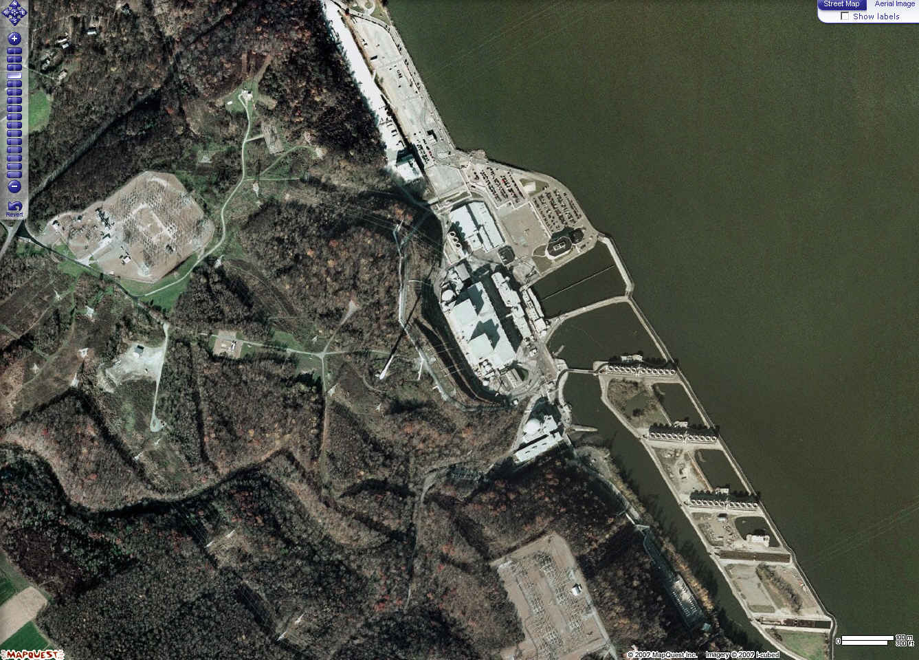
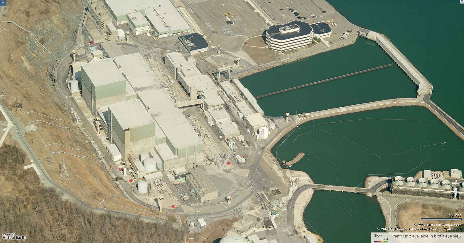
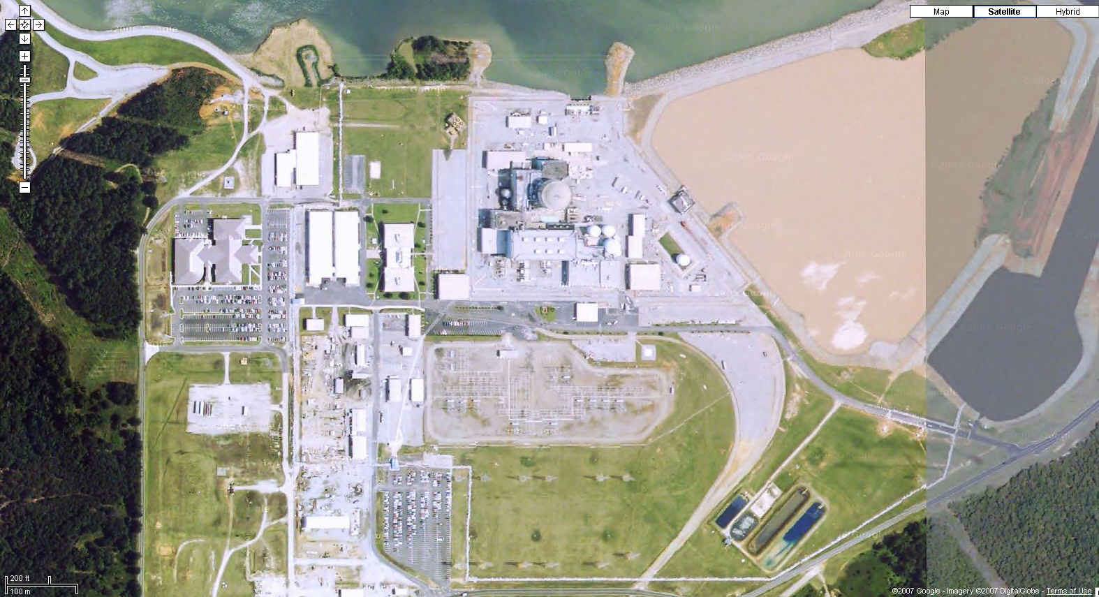
Calvert Cliffs Nuclear Power Station, MD
Clinton Power Station, IL
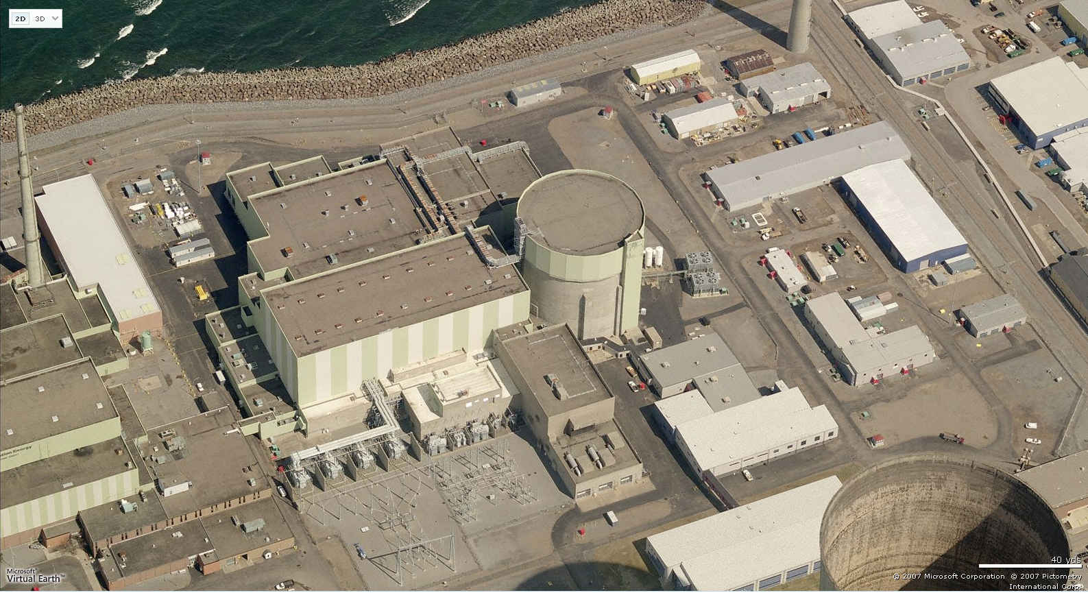
Columbia Generating Station, WA
Cooper Nuclear Power Station, NE
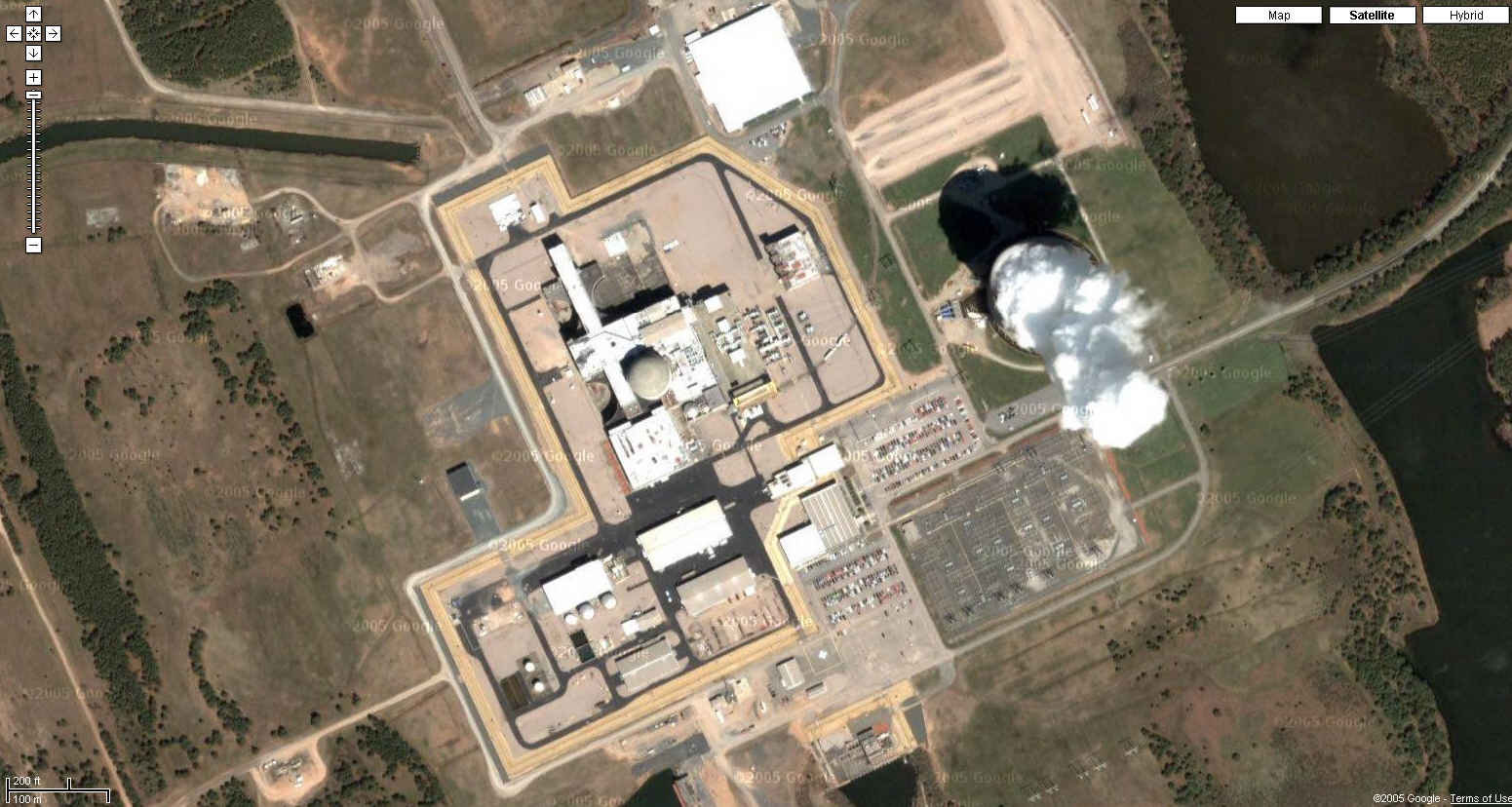
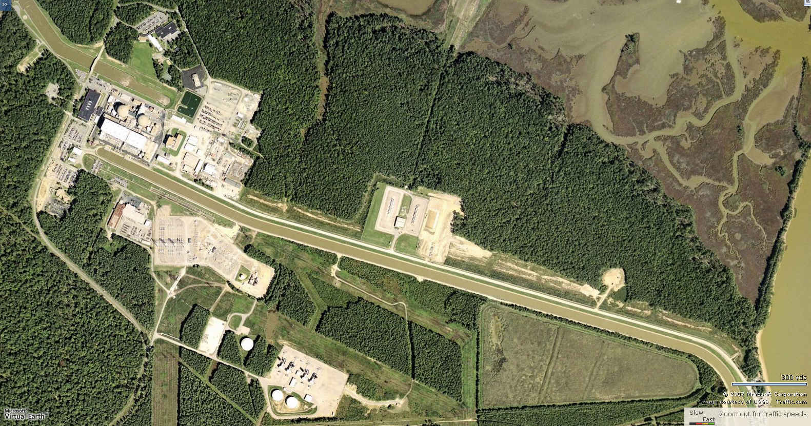
Crystal River Nuclear Power Plant, FL
Grand Gulf Nuclear Station, MS
North Anna Nuclear Power Station, VA
Oconee Nuclear Power Station, SC
Palisades Nuclear Power Plant, MI
Quad Cities Generating Station, IL
River Bend Station, LA
Robinson Nuclear Power Station, SC
Summer Nuclear Power Plant, SC
Surry Nuclear Power Station, VA
Susquehanna Nuclear Power Station, PA
Three Mile Island Nuclear Power Station, PA
Waterford 3 Steam Electric Station, LA
Vogtle Nuclear Power Station, GA
Vermont Yankee Nuclear Power Station, VT
And Local Live birdseyes:
Fitzpatrick/Nine Mile Point Nuclear Power Plant
Ginna Nuclear Power Plant
Indian Point Nuclear Generating Station, NY
Peach Bottom Atomic Power Plant, PA
Pilgrim Nuclear Power Station, MA
Sequoyah Nuclear Power Plant, TN
Three Mile Island Nuclear Power Station, PA
22 January 2006. Add color aerials of North Anna NPP and Surry NPS, VA, Brunswick NPS, NC, and South Texas Project Electric Generating Station, TX.
17 January 2006. Add 29 Google Maps color aerials dated about 2004:
Callaway NPP, MO
Catawba NPP, SC
Comanches Peak NPP, TX
Cook NPP, MI
Davis-Besse NPP, OH
Diablo Canyon NPS, CA
Duane Arnold Energy Center, IA
Farley NPP, AL
Fermi 2 NPP, MI
Fort Calhoun NS, NE
Harris NPP, NC
Hatch NPS, GA
Indian Point NGS, NY
LaSalle County GS, IL
Limerick NPS, PA
Millstone NPS, CT
Monticello NGP, MN
Oyster Creek NPP, NJ
Palo Verde NPS, AZ
Perry NPP, OH
Pilgrim NPS, MA
Salem/Hope Creek (Artificial Island) NPP, NJ
San Onofre NPP, CA
St. Lucie NPP, FL
Seabrook NPP, NH
Sequoyah NPP, TN
Turkey Point NPP, FL
Watts Bar NGS, TN
Wolf Creek NGS, KS
Correct location of Quad Cities Generating Station, IL
6 November 2005. Thanks to A, add correct photo of Beaver Valley Nuclear Power Station, not the upriver coal-fired plant.
17 September 2005. Updated with NOAA photo of Waterford 3 plant, taken for Katrina hurricane assessment.
28 February 2005. See color high-resolution 2002 photos of Oyster Creek and Salem-Hope Creek Nuclear Plants:
http://cryptome.org/oyster-eyeball.htm
Add color hi-resolution photos of Braidwood, Dresden and McGuire.
7 March 2004. Update URLs of reactor locations to Terraserver-USA.com.
19 July 2002. List of 104 reactors and their operators:
http://www.nrc.gov/reactors/operating/list-power-reactor-units.html
5 July 2002. Revise Columbia Generating Station. See maps of US energy systems:
http://cryptome.org/energy-eyeball.htm
1 July 2002. Add Columbia Generating Station.
20 June 2002
This presents information on 104 US nuclear reactors at 63 power plants operating in 2000 listed by the Deparment of Energy:
Nuclear Reactors Operating in the United States, 2000By state:
http://www.eia.doe.gov/cneaf/nuclear/page/at_a_glance/reactors/states.html
By name:
http://www.eia.doe.gov/cneaf/nuclear/page/at_a_glance/reactors/nuke1.html
Geographical coordinates and FEMA's Radiological Emergency Preparedness report are provided for each plant. Aerial photos from TerraServer are the same scale for all plants. Photo links will amplify site information with maps and other photo scales.
See related US Nuclear Weapons Storage Areas: http://cryptome.org/nwsa-eyeball.htm
|
 |
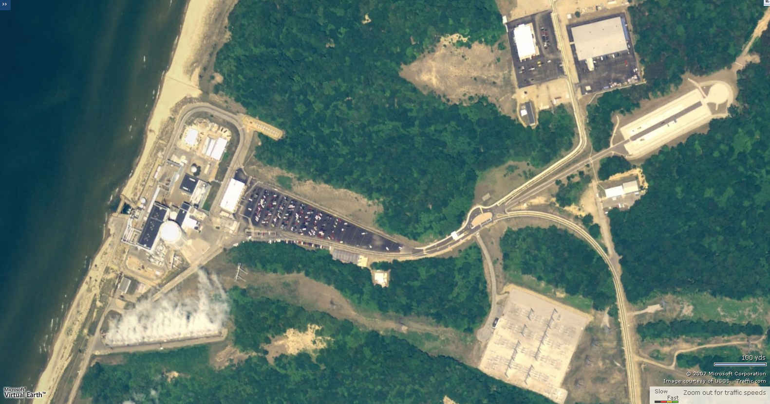
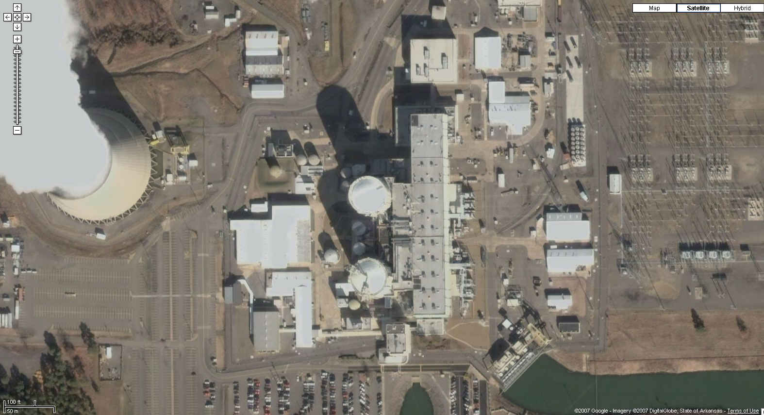
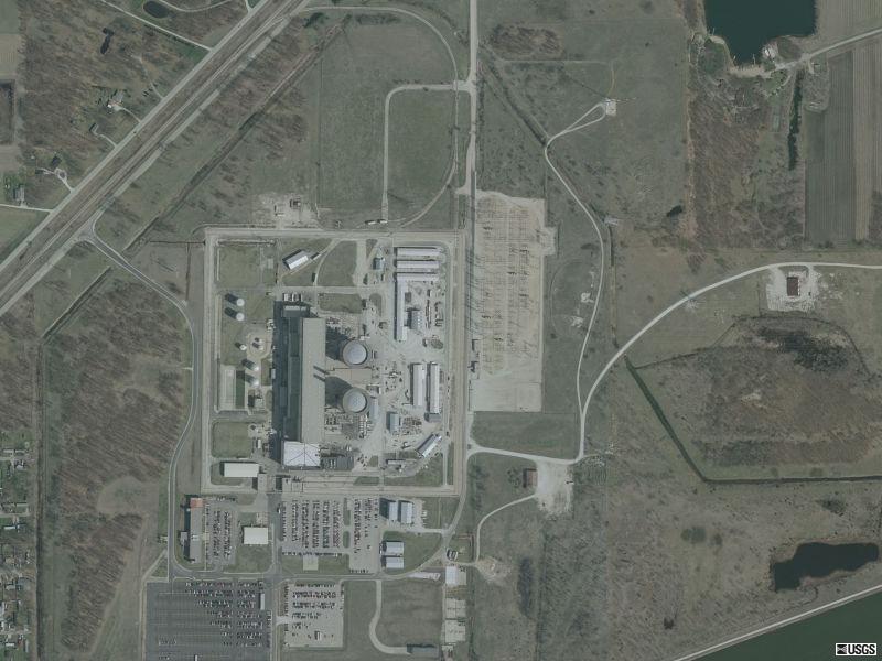
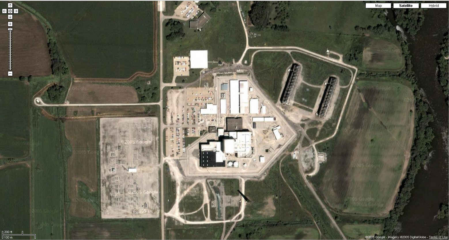
| Arkansas Nuclear One Russellville, Arkansas
35N 18' 28", 93W 13' 60" |
| http://maps.google.com/maps?f=q&hl=en&geocode=&time=&date=&ttype=&q=russellville,ar&ie=UTF8&ll=35.310595,-93.231676&spn=0.003747,0.008497&t=k&z=18&iwloc=addr&om=0
|
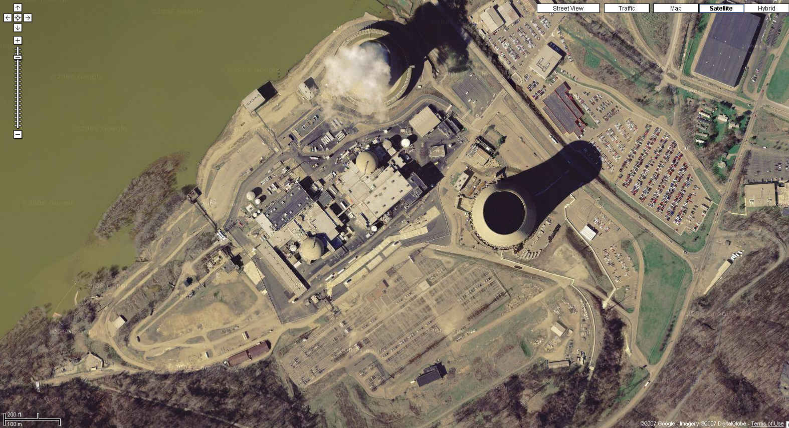
| Beaver Valley Nuclear Power Station Shippingport, Pennsylvania
40N 37' 27.42", 80W 25' 56.69" |
| http://maps.google.com/maps?f=q&hl=en&geocode=&time=&date=&ttype=&q=shippingport,pa&ie=UTF8&ll=40.622332,-80.431541&spn=0.006971,0.016994&t=k&z=17&om=0
|
| Braidwood Generating Station Will County, Illinois
41N 14' 33", 88W 13' 54" |
| USGS
color photos April 2002
|
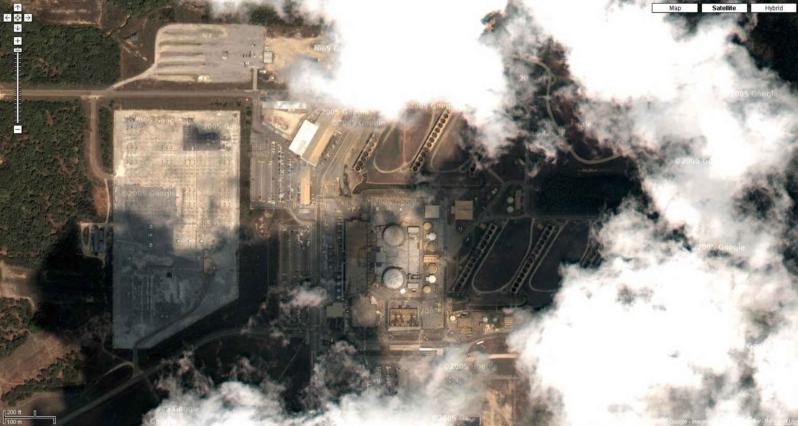
| Browns Ferry Nuclear Power Plant Limestone County, Alabama
34N 42' 07", 87W 07' 05" |
| http://maps.google.com/maps?f=q&hl=en&geocode=&time=&date=&ttype=&q=athens,al&ie=UTF8&ll=34.704779,-87.117859&spn=0.00755,0.016994&t=k&z=17&iwloc=addr&om=0
|
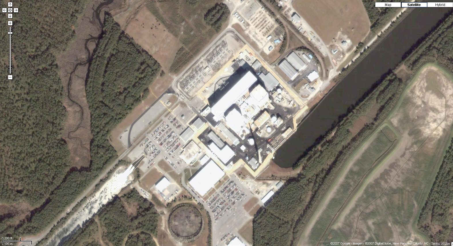
| Brunswick Nuclear Power Station Southport, North Carolina
33N 57' 19", 78W 00' 49" |
| http://maps.google.com/maps?f=q&hl=en&geocode=&time=&date=&ttype=&q=Southport,+North+Carolina&ie=UTF8&ll=33.95784,-78.010472&spn=0.007618,0.016994&t=k&z=17&om=0
|
| Byron Generating Station Ogle County, Illinois
42N 04' 22", 89W 17' 13" |
| http://maps.google.com/maps?f=q&hl=en&geocode=&time=&date=&ttype=&q=byron,+il&ie=UTF8&ll=42.074264,-89.282144&spn=0.006817,0.016994&t=k&z=17&iwloc=addr&om=0
|
| Callaway Nuclear Power Station Reform, Missouri
38N 45' 35", 91W 47' 05" |
| Google
Map Photo
|
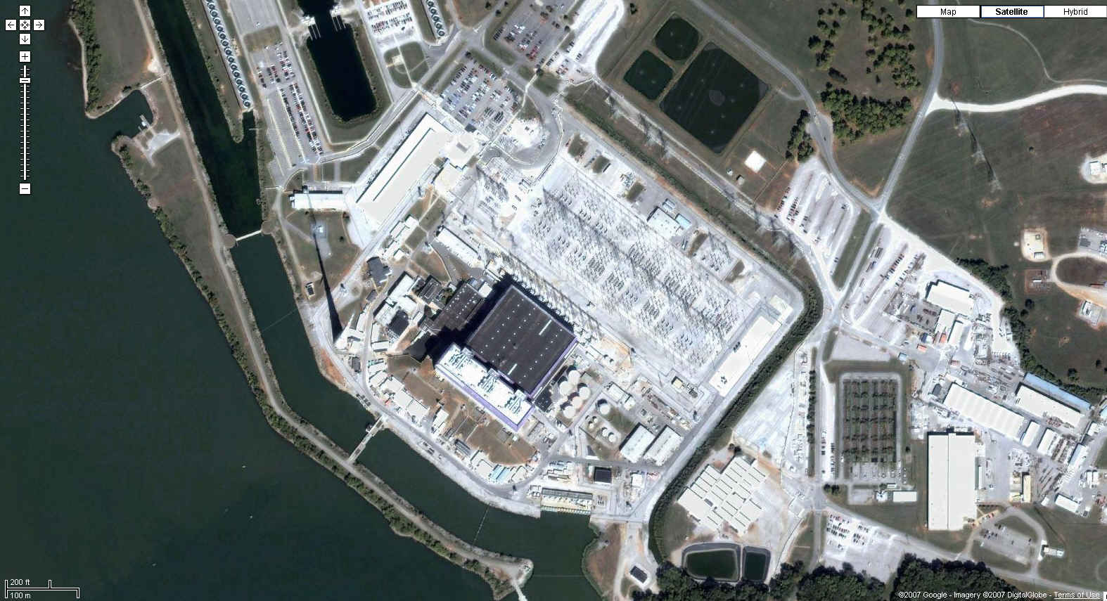
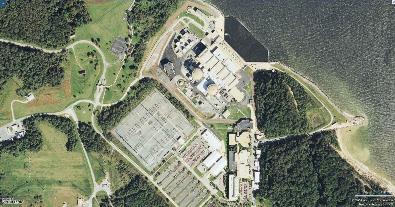
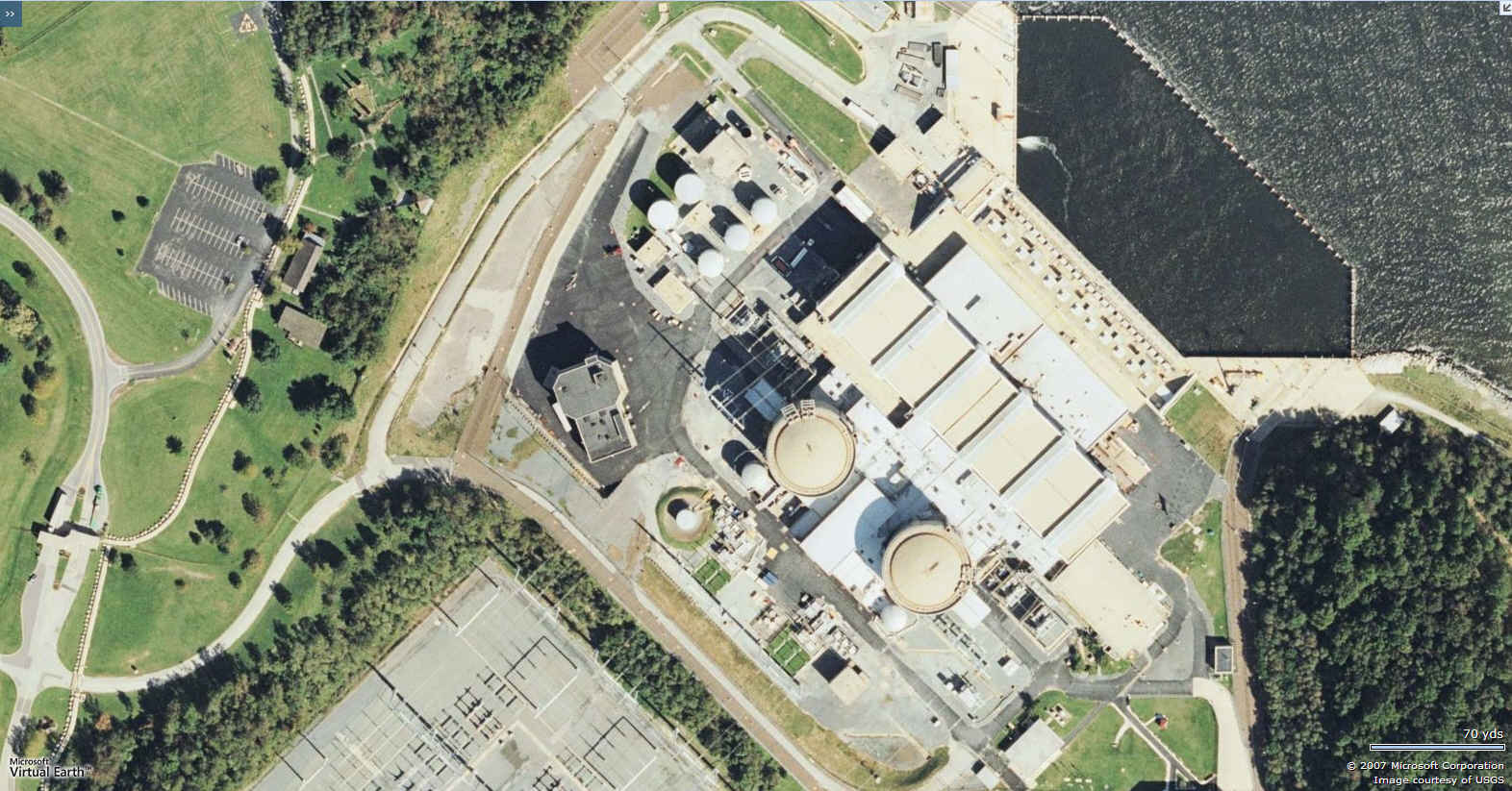
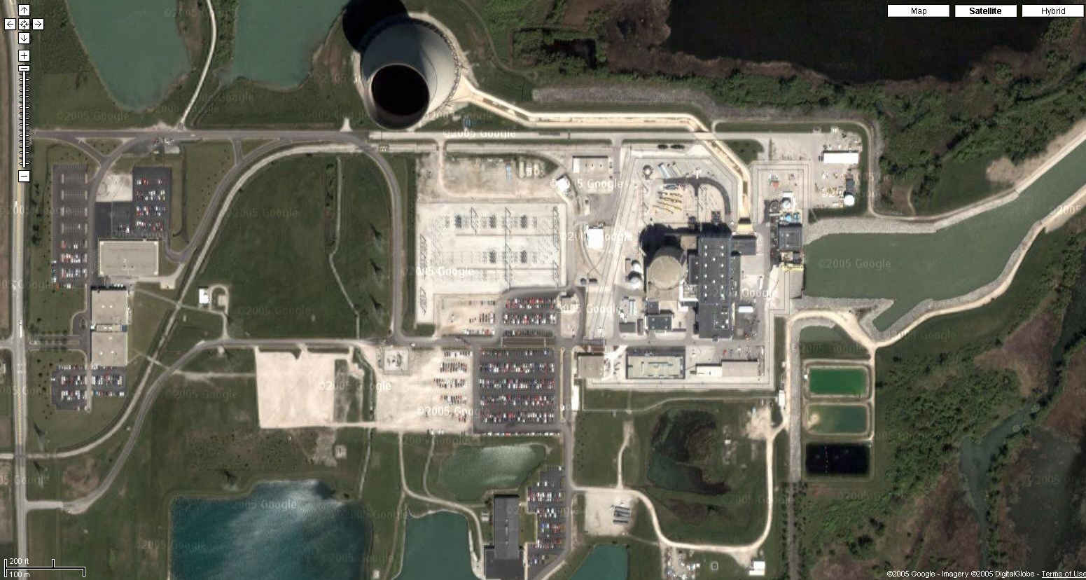
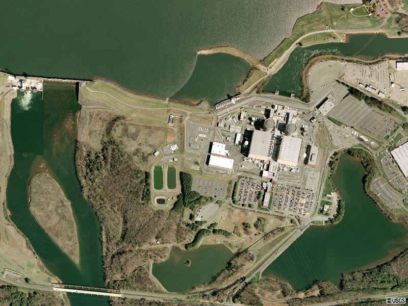
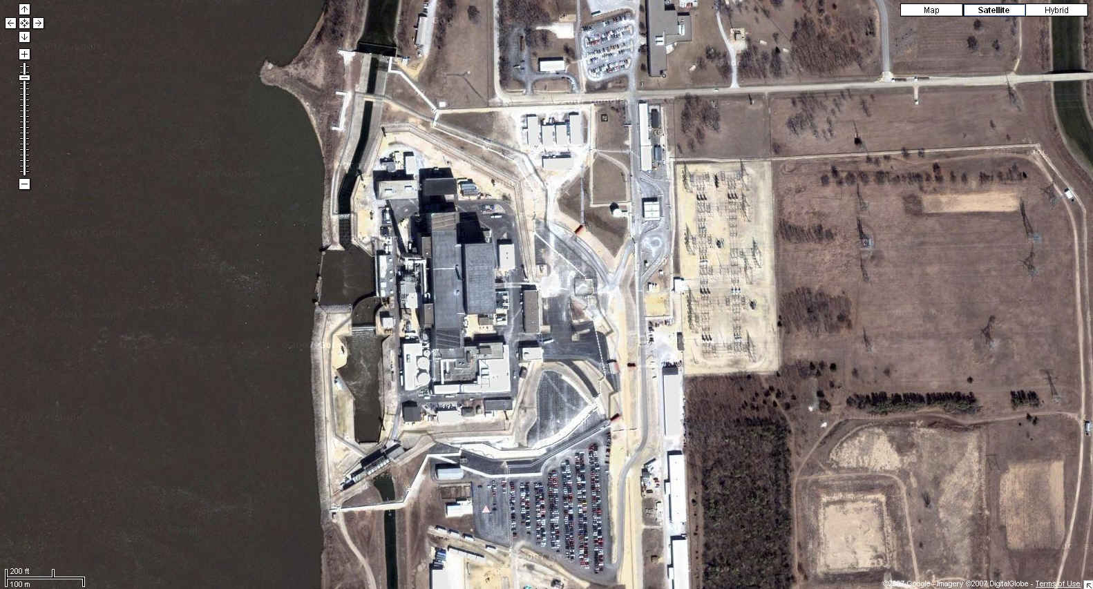
| Calvert Cliffs Nuclear Power Station Lusby, Maryland
38N 25' 57", 76W 26' 37" |
| Maps.Live.com
|
| Maps.Live.com
|
| Catawba Nuclear Power Station Rock Hill, South Carolina
35N 02' 54", 81W 04' 13" |
| Google
Maps Photo
|
| Clinton Power Station Dewitt County, Illinois
40N 10' 17", 88W 50' 12" |
| http://maps.google.com/maps?f=q&hl=en&geocode=&time=&date=&ttype=&q=clinton,il&ie=UTF8&ll=40.172061,-88.833164&spn=0.007018,0.016994&t=k&z=17&iwloc=addr&om=0
|
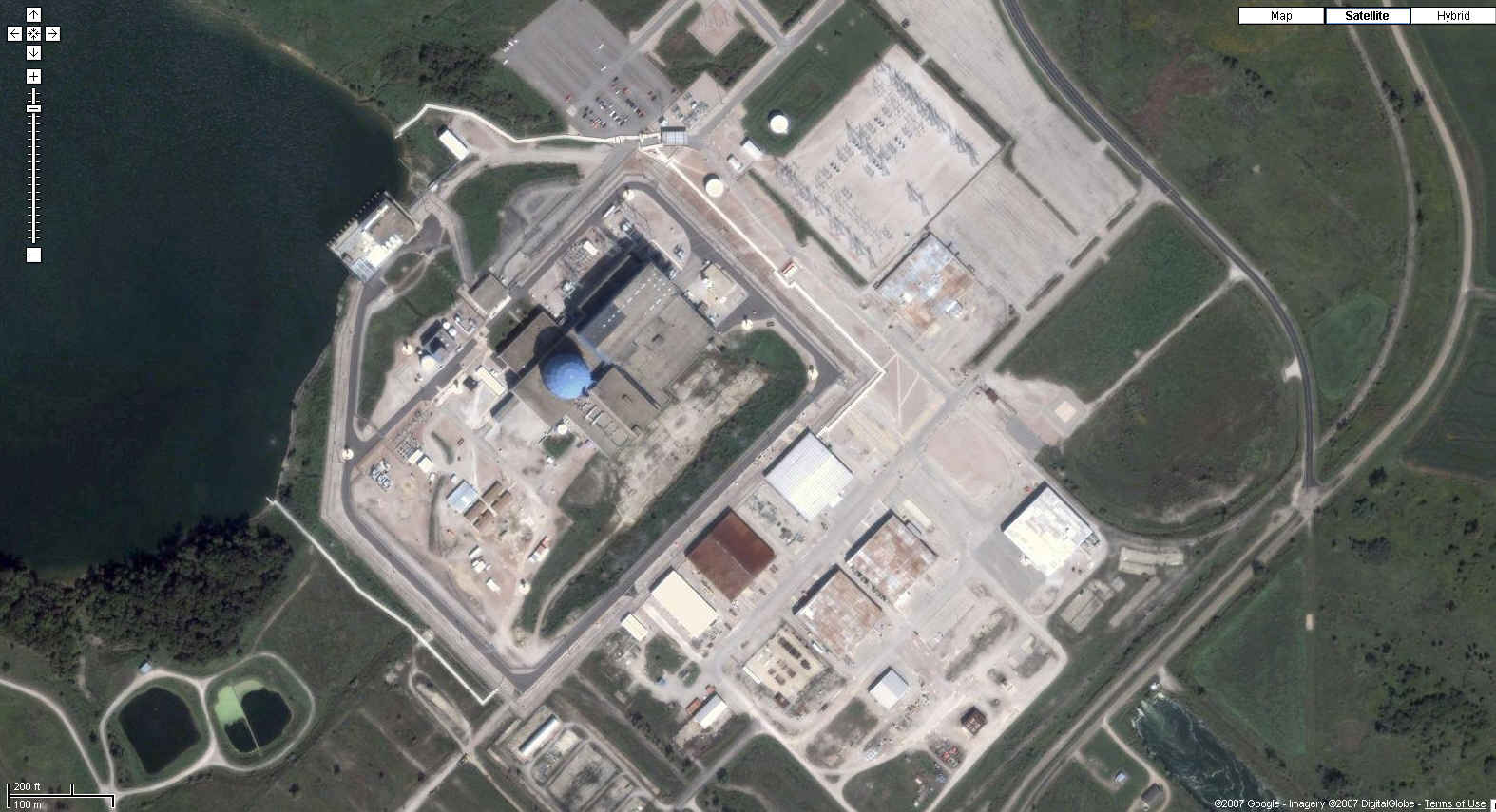
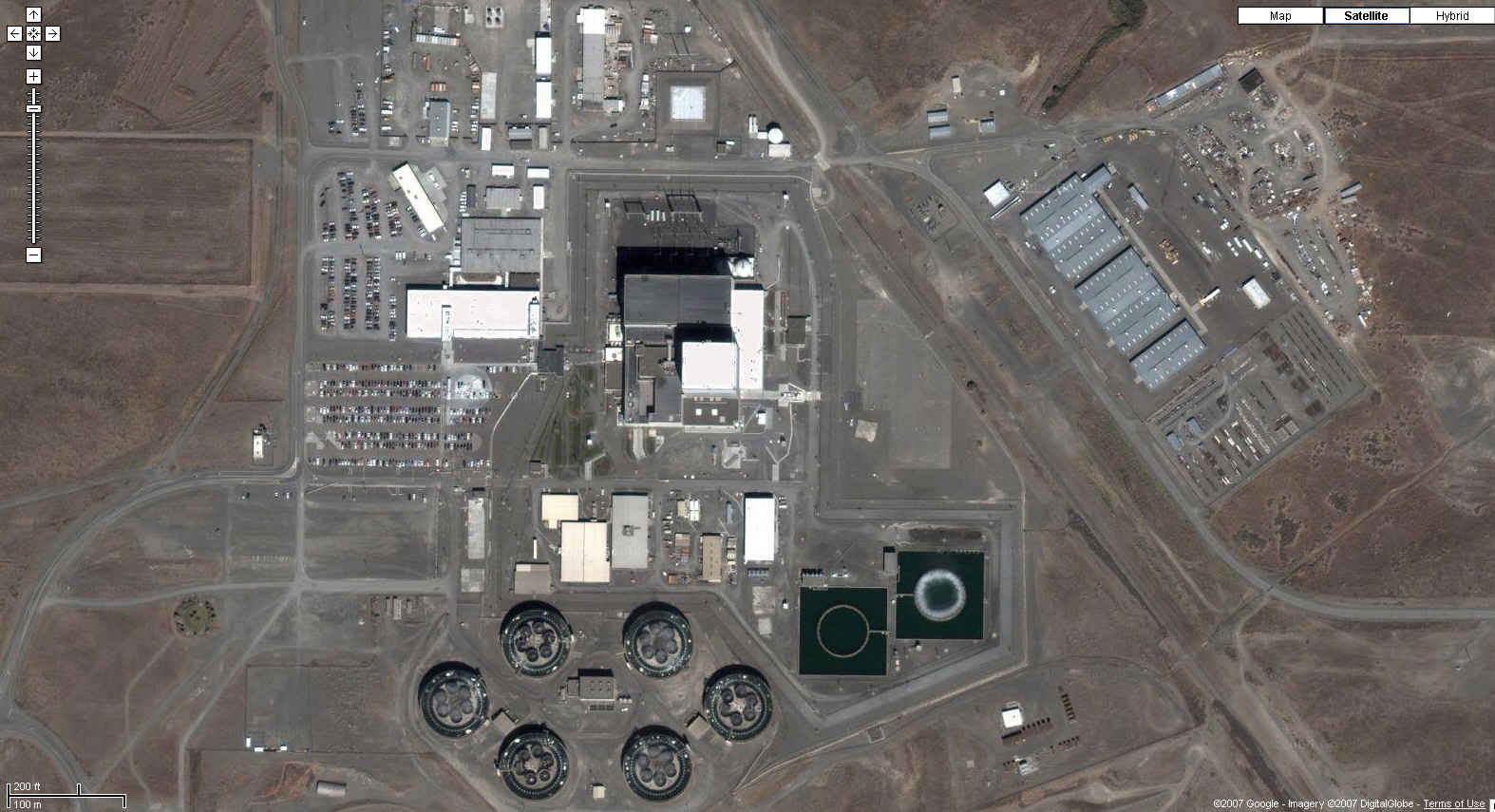
| Columbia Generating Station Richland, WA
46N 28' 07", 119W 20' 02" Notice of Violation of Emergency Preparedness, December 2001 |
| http://maps.google.com/maps?f=q&hl=en&geocode=&time=&date=&ttype=&q=richland,wa&ie=UTF8&ll=46.470904,-119.333442&spn=0.006325,0.016994&t=k&z=17&iwloc=addr&om=0
|
| Comanche Peak Nuclear Steam Electric Station Glen Rose, Texas
32N 17' 49", 97W 47' 05" |
| Google
Maps Photo
|
| Cook Nuclear Power Plant Berrien County, Michigan
41N 58' 34", 86W 33' 56" |
| Google
Maps Photo
|
| Cooper Nuclear Power Station Brownville, Nebraska
40N 21' 40", 95W 38' 34" |
| http://maps.google.com/maps?f=q&hl=en&geocode=&time=&date=&ttype=&q=Brownville,+Nebraska&ie=UTF8&ll=40.361968,-95.642257&spn=0.003499,0.008497&t=k&z=18&om=0
|
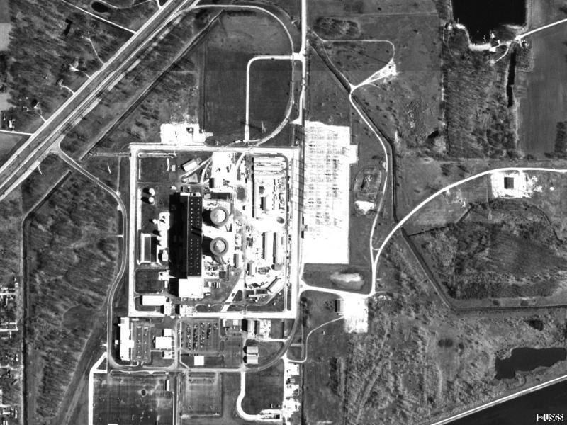
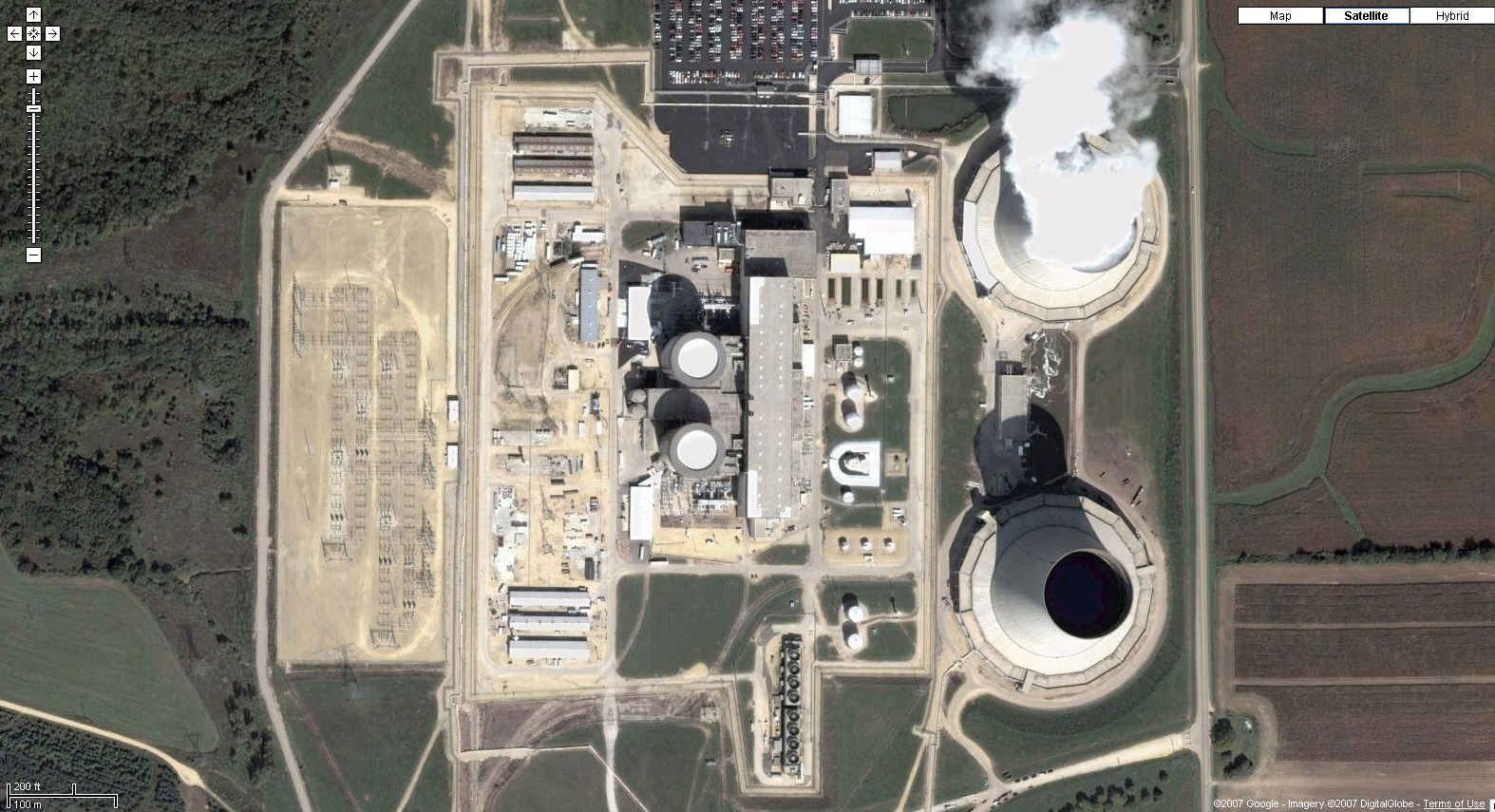
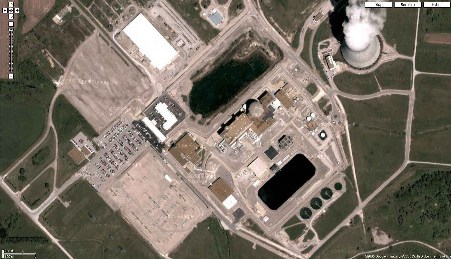
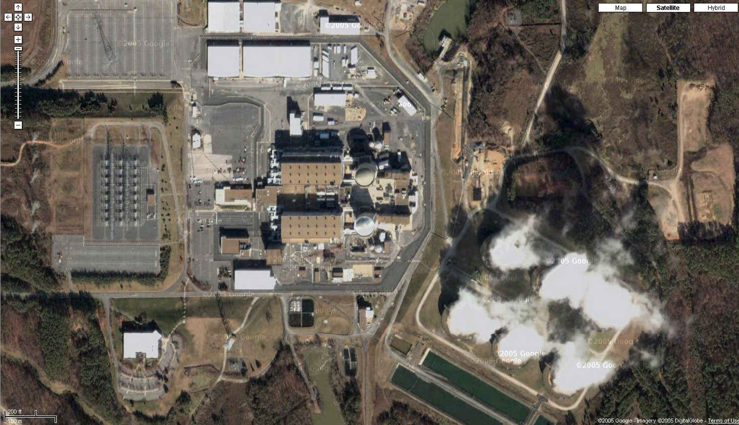
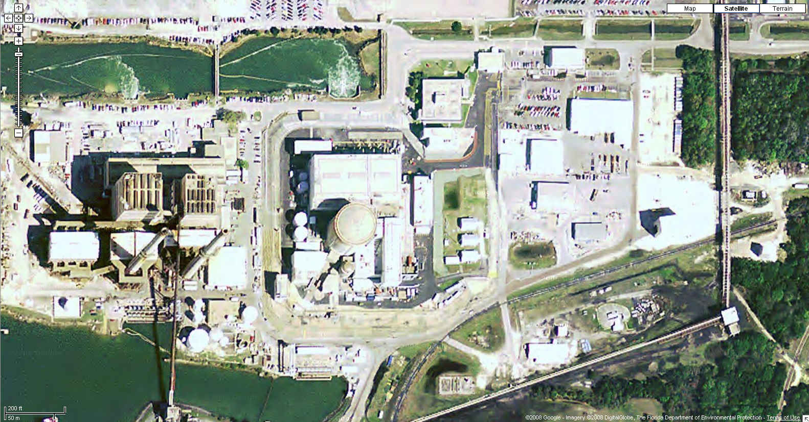
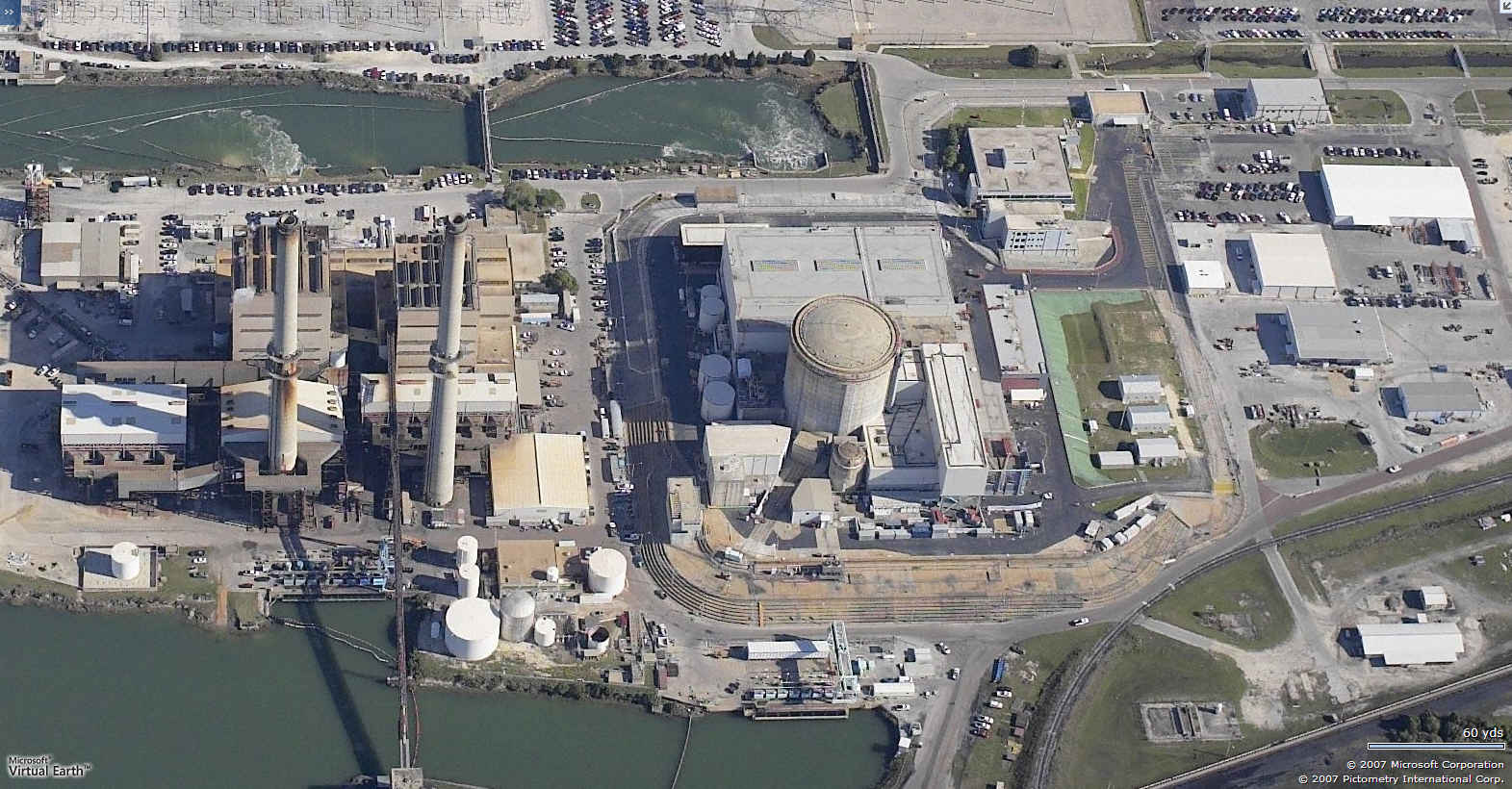
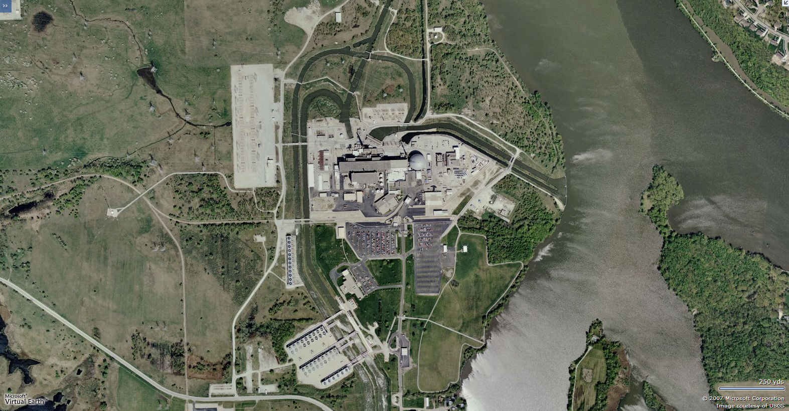
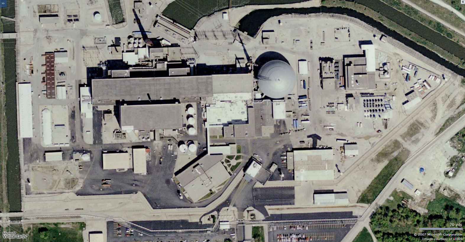
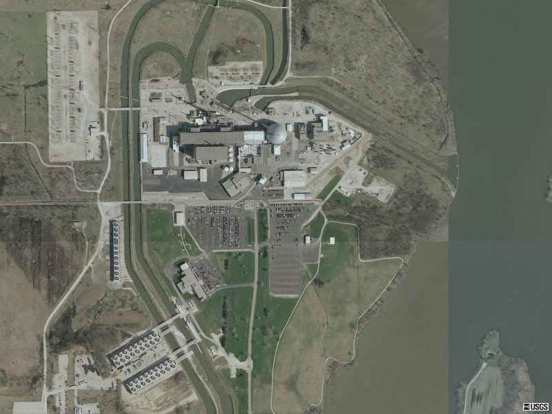
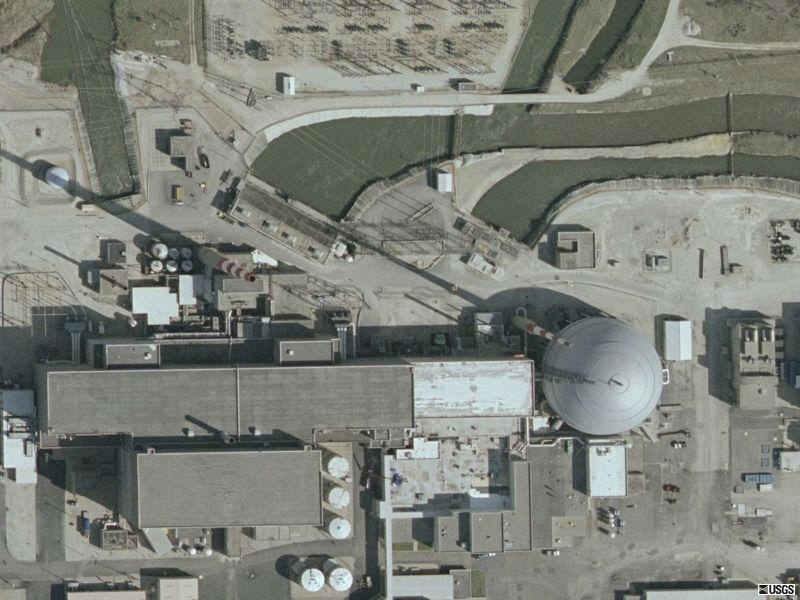
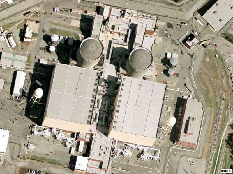
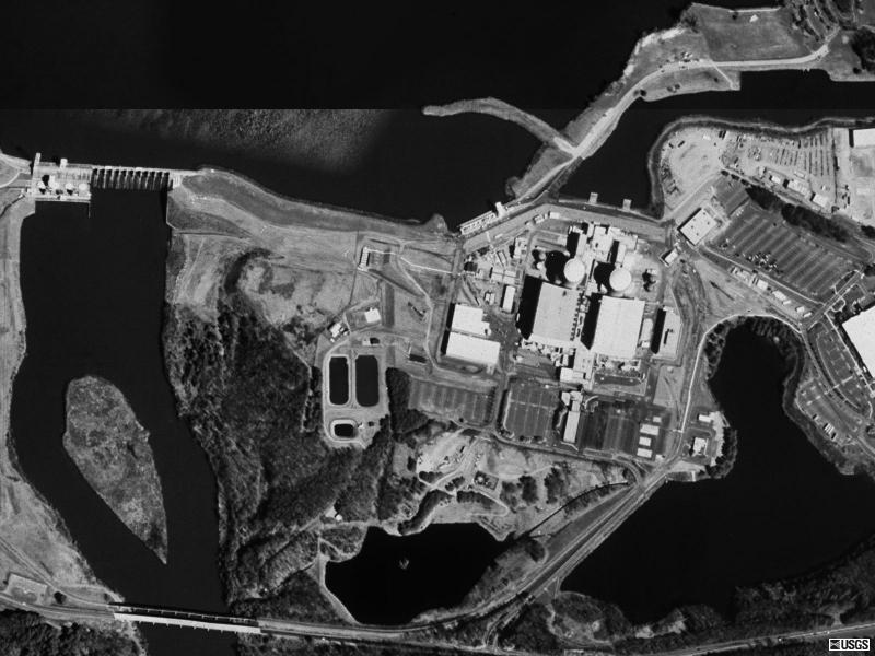
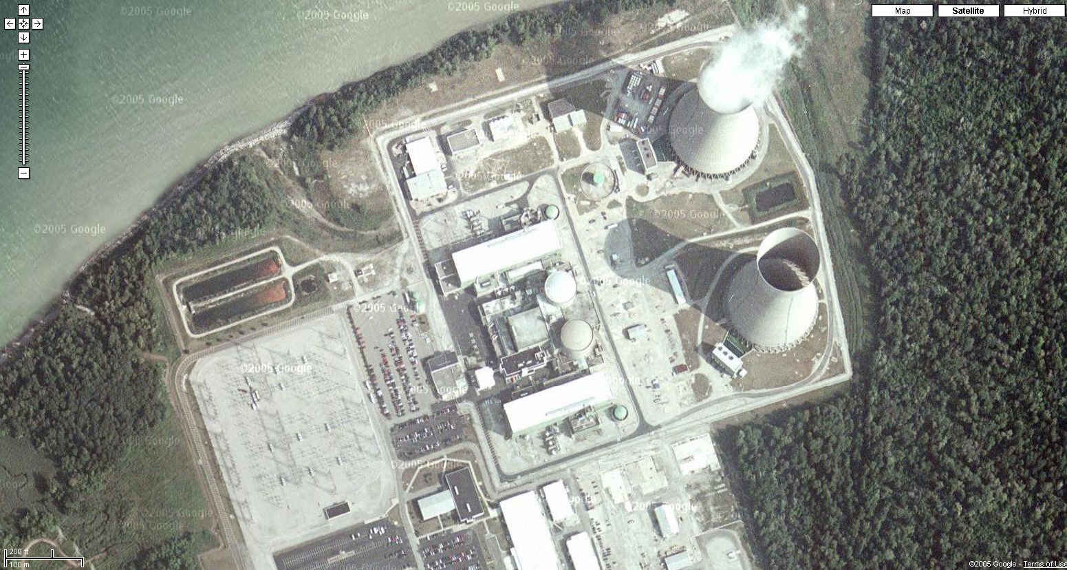
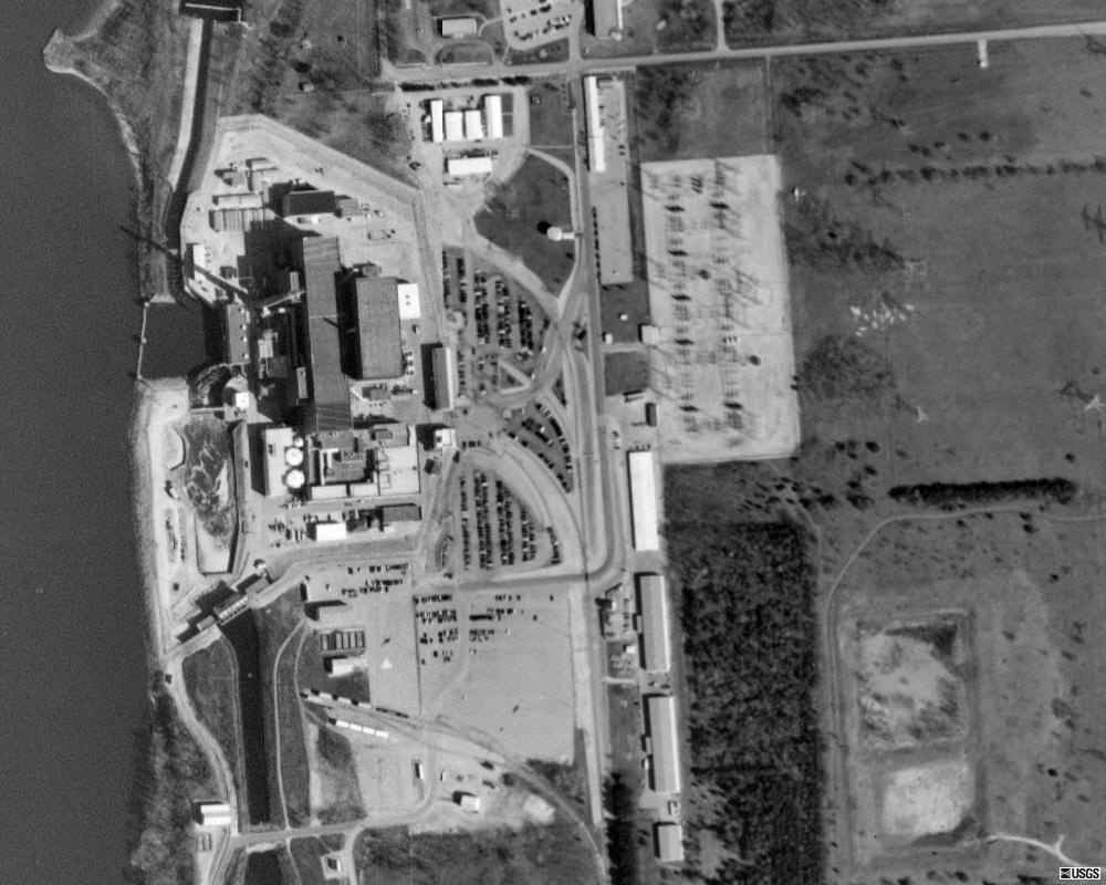
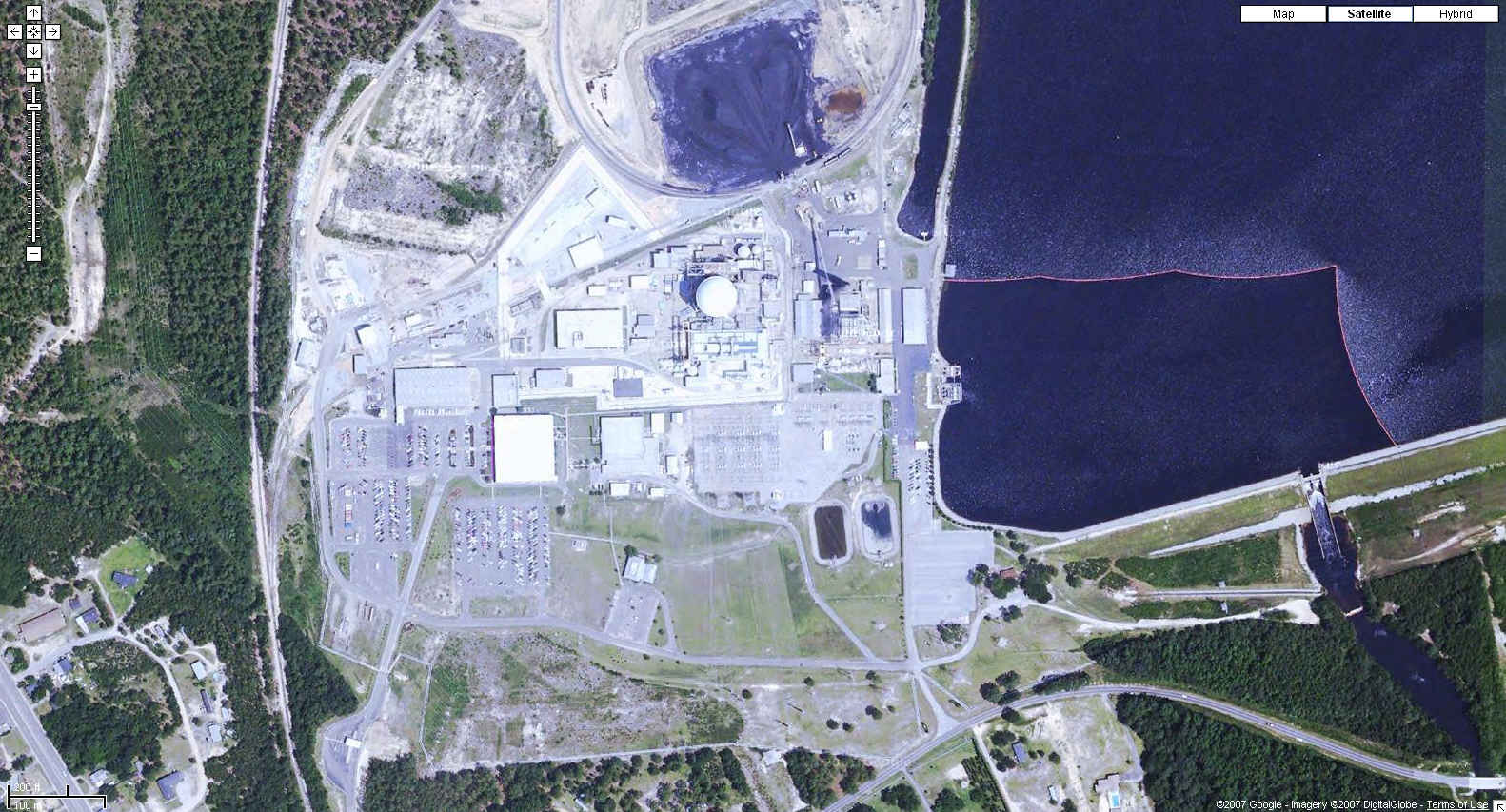
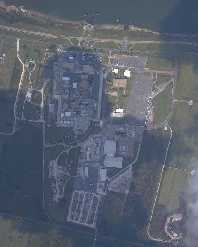
| Crystal River Nuclear Power Plant Crystal River, Florida
28N 57' 37", 82W 41' 58" |
| http://maps.google.com/maps?f=q&hl=en&geocode=&time=&date=&ttype=&q=Crystal+River,+Florida&ie=UTF8&t=k&om=0&ll=28.957596,-82.697809&spn=0.003886,0.008497&z=18&iwloc=addr
|
| Maps.Live.com
|
| USGS
photo 30 Dec 1998
|
| Davis-Besse Nuclear Power Plant Ottawa County, Ohio
41N 35' 38", 83W 05' 17" |
| Google
Maps Photo
|
| Diablo Canyon Nuclear Power Station San Luis Obispo County, California
35N 12' 35", 120W 51' 20" |
| Google
Maps Photo
|
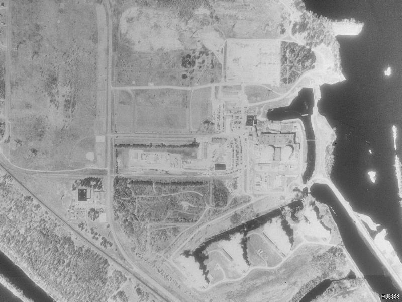
| Dresden Nuclear Generating Station Grundy County, Illinois
41N 23' 23", 88W 16' 05" |
||
| Maps.Live.com
|
||
| Maps.Live.com
|
||
USGS
color photos April 2002
|
| Duane Arnold Energy Center Palo, Iowa
42N 06' 00", 91W 46' 52" |
| Google
Maps Photo
|
| Farley Nuclear Power Plant Houston County, Alabama
31N 13' 15", 85W 06' 52" |
| Google
Maps Photo
|
| Fermi 2 Nuclear Power Plant Monroe County, Michigan
41N 57' 42", 83W 15' 32" |
| Google
Maps Photo
|
| Fitzpatrick/Nine Mile Point Nuclear Power Plant Scriba, New York
43N 31' 14", 76W 24' 38" |
| Local Live
|
| USGS
photo 27 Mar 1995
|
| Fort Calhoun Nuclear Station Blair, Nebraska
41N 31' 06", 96W 04' 49" |
| Google
Maps Photo
|
| Ginna Nuclear Power Plant Township of Ontario, New York
43N 16' 31", 77W 18' 44" |
| Local Live
|
| USGS
photo 22 Apr 1994
|
| Grand Gulf Nuclear Station Port Gibson, Mississippi
32N 00' 23", 91W 03' 07" |
| http://maps.google.com/maps?f=q&hl=en&geocode=&time=&date=&ttype=&q=Port+Gibson,+Mississippi&ie=UTF8&ll=32.006666,-91.047446&spn=0.007788,0.016994&t=k&z=17&om=0
|
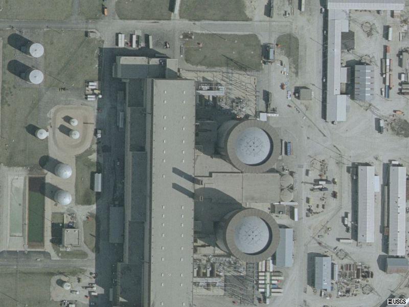
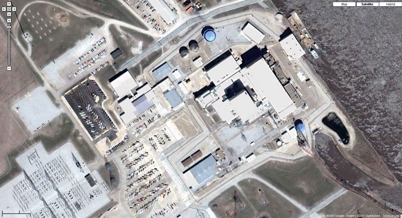
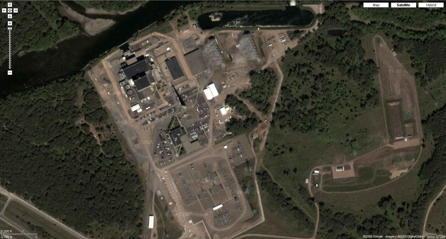
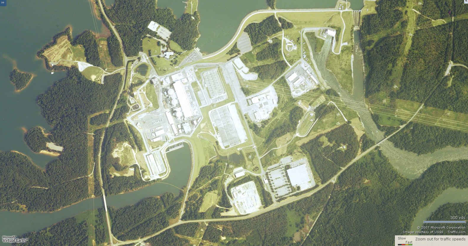
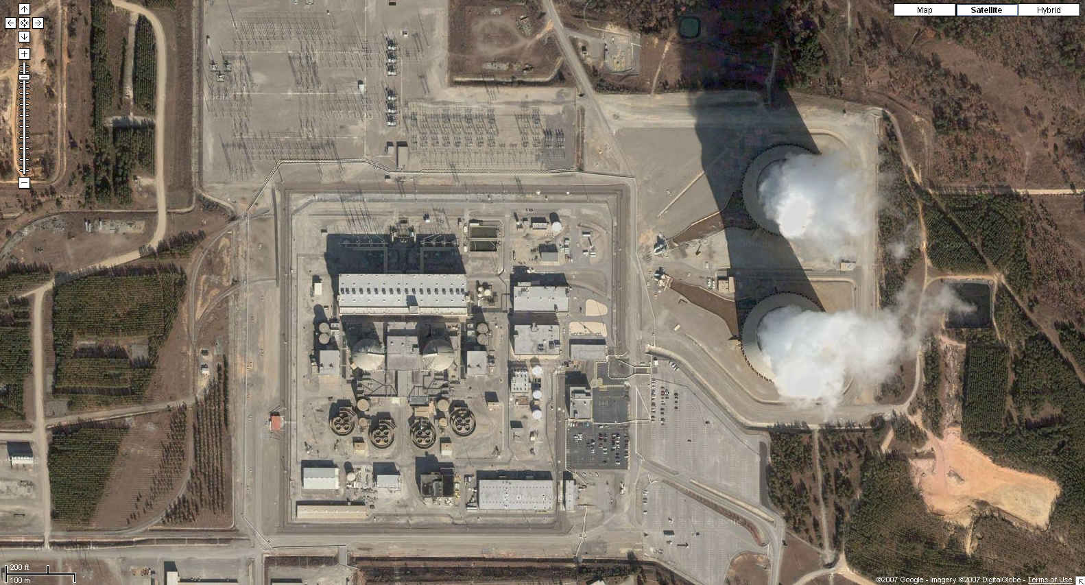
| Harris Nuclear Power Station Wake County, North Carolina
35N 38' 00", 78W 57' 17" |
| http://www.bing.com/maps/default.aspx?v=2&FORM=LMLTCP&cp=py4y9q8dmcf9&style=o&lvl=1&tilt=-90&dir=0&alt=-1000&phx=0&phy=0&phscl=1&scene=19629025&encType=1
|
| Google
Maps Photo
|
| Hatch Nuclear Power Station Baxley, Georgia
31N 56' 05", 82W 20' 44" |
| Google
Maps Photo
|
| Indian Point Nuclear Generating Station Buchanan, New York
41N 16' 10", 73W 57' 15" |
| Google
Maps Photo
|
| Local Live
|
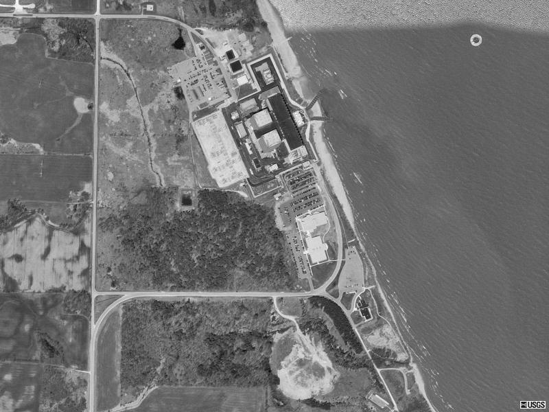
| Kewaunee Nuclear Power Plant Kewaunee County, Wisconsin
44N 20' 31", 87W 32' 13" |
| USGS
photo 6 May 1992
|
| LaSalle County Generating Station LaSalle County, Illinois
41N 14' 38", 88W 40' 15" |
| Google
Maps Photo
|
| Limerick Nuclear Power Station Pottstown, Pennsylvania
40N 13' 27", 75W 35' 16" |
| Google
Maps Photo
|
| McGuire Nuclear Power Station Cowans Ford Dam, North Carolina
35N 25' 50", 80W 57' 06" |
| USGS
color photos April 2002
|
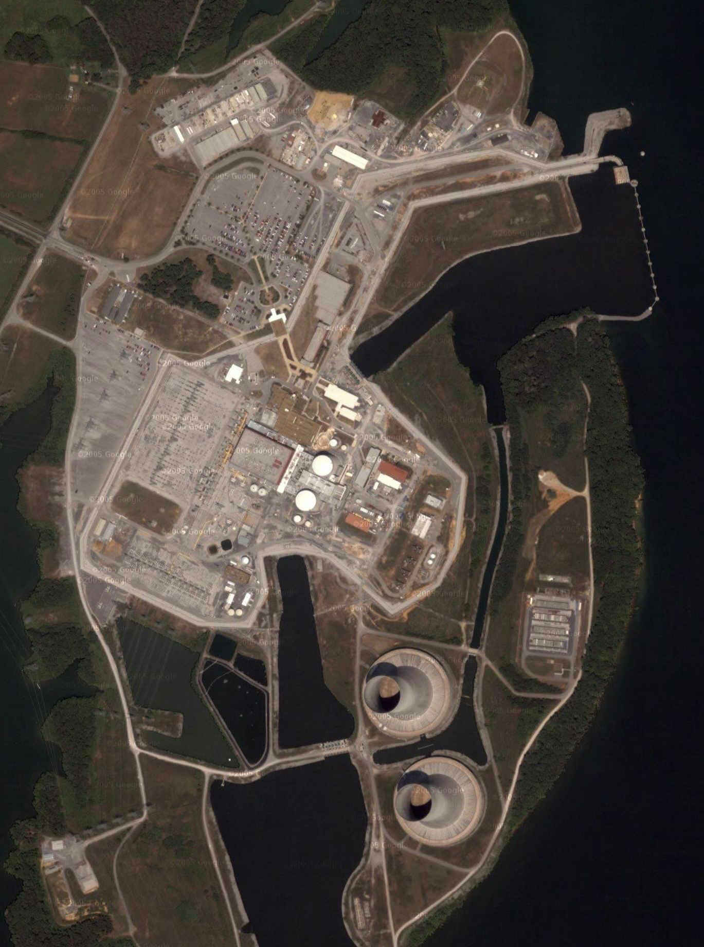
| Millstone Nuclear Power Station Waterford, Connecticut
41N 18' 29", 72W 10' 16" |
| Google
Maps Photo
|
| Monticello Nuclear Generating Plant Monticello, Minnesota
45N 19' 49", 93W 51' 09" |
| Google
Maps Photo
|
| North Anna Nuclear Power Station Mineral, Virginia
38N 03' 30", 77W 47' 26" |
| http://maps.google.com/maps?f=q&hl=en&geocode=&time=&date=&ttype=&q=Mineral,+Virginia&ie=UTF8&ll=38.060535,-77.791378&spn=0.007231,0.016994&t=k&z=17&om=0
|
| Oconee Nuclear Power Station Seneca, South Carolina
34N 47' 30", 82W 54' 07" |
| http://www.mapquest.com/maps/map.adp?formtype=address&addtohistory=&address=&city=Oconee%20Point&state=SC&zipcode= &country=US&location=i3BbCb9UB6KBjRPEWVAGKd%2fioMxyWFSfSgreImz7QqdinUXImxqGMWZPQbLzhiDmaoEolpp9ged3kaHpeuElIyL5KiUjO2LI5R%2bsC8AoYSjHLY5gsfVzx5zLrI5hn2O8&ambiguity=1
|
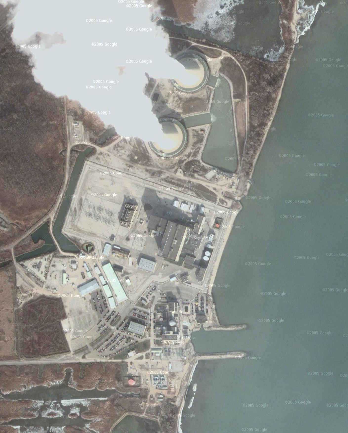
| Oyster Creek Nuclear Power Plant Lacey and Ocean Townships, New Jersey
39N 48' 57", 74W 12' 20" |
| Google
Maps Photo
|
| Palisades Nuclear Power Plant Van Buren County, Michigan
42N 19' 14", 86W 18' 56" |
 |
| Palo Verde Nuclear Power Station Maricopa County, Arizona
33N 23' 08", 112W 51' 60" |
| Google
Maps Photo
|
| Peach Bottom Nuclear Power Station Peach Bottom Township, Pennsylvania
39N 45' 26", 76W 16' 13" |
| http://www.mapquest.com/maps/map.adp?formtype=address&country=US&popflag=0&latitude=&longitude=&name=&phone=&level= &addtohistory=&cat=&address=&city=Peach+Bottom&state=pa&zipcode=
|
| Local Live
|
| Perry Nuclear Power Plant Lake County, Ohio
41N 48' 01", 81W 08' 40" |
| Google
Maps Photo
|
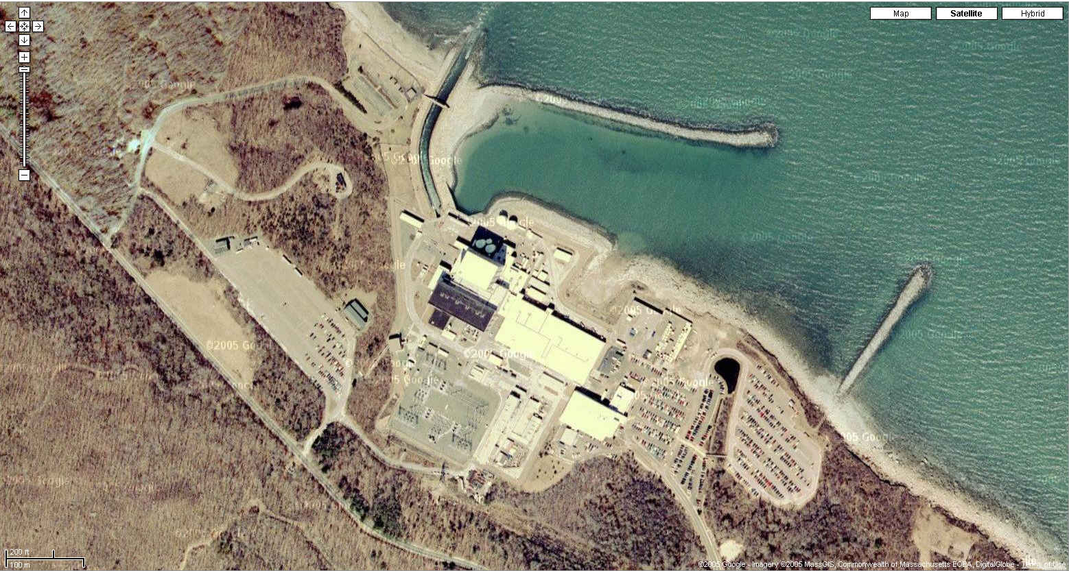
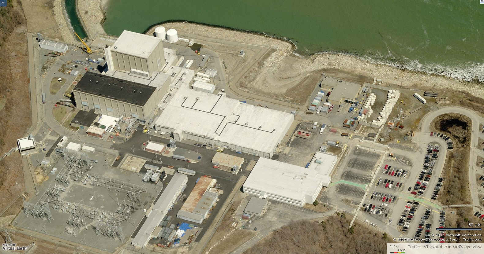
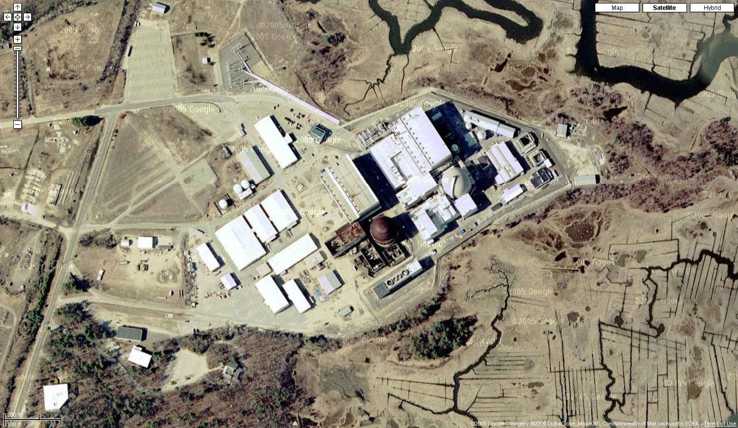
| Pilgrim Nuclear Power Station Plymouth, Massachusetts
41N 56' 39", 70W 34' 58" |
| Google
Maps Photo
|
| Local Live
|
| Point Beach Nuclear Power Plant Manitowoc County, Wisconsin
44N 16' 51", 87W 32' 11" |
| USGS
photo 23 Apr 2000
|
| Prairie Island Nuclear Generating Plant Goodhue County, Minnesota
44N 37' 12", 92W 38' 13" |
| USGS
photo 10 Apr 1991
|
| Quad Cities Generating Station Cordova, Illinois
41N 43' 32.26", 90W 18' 41.67" |
| http://maps.google.com/maps?f=q&hl=en&geocode=&time=&date=&ttype=&q=Cordova,+Illinois&ie=UTF8&ll=41.726222,-90.308787&spn=0.006862,0.016994&t=k&z=17&iwloc=addr&om=0
|
| USGS
photo 30 March 2000
|
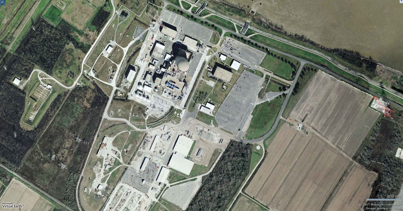
| River Bend Station St. Francisville, Louisiana
30N 45' 17", 91W 19' 57" |
| http://www.mapquest.com/maps/map.adp?formtype=address&country=US&popflag=0&latitude=&longitude=&name=&phone= &level=&addtohistory=&cat=&address=&city=St.+Francisville&state=la&zipcode=
|
| Robinson Nuclear Power Station Hartsville, South Carolina
34N 23' 59", 80W 09' 36" |
| http://maps.google.com/maps?f=q&hl=en&geocode=&time=&date=&ttype=&q=Hartsville,+South+Carolina&ie=UTF8&ll=34.402023,-80.157902&spn=0.007586,0.016994&t=k&z=17&iwloc=addr&om=0
|
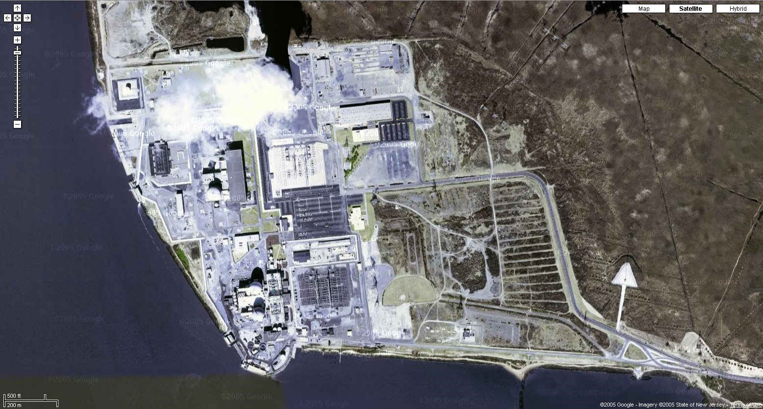
| Salem/Hope Creek (Artificial Island) Nuclear Power Plant Lower Alloways Creek Township, New Jersey
39N 27' 50", 75W 32' 05" |
| Google
Map Photo
|
| San Onofre Nuclear Power Station San Diego County, California
33N 22' 10", 117W 33' 17" |
| Google
Maps Photo
|
| Seabrook Nuclear Power Station Seabrook, New Hampshire
42N 53' 54", 70W 51' 07" |
| Google
Maps Photo
|
| Sequoyah Nuclear Power Station Soddy-Daisy, Tennessee
35N 13' 28", 85W 05' 33" |
| Google
Maps Photo
|
| Local Live
|
| South Texas Project Electric Generating Station Bay City, Texas
28N 47' 41", 96W 02' 59" |
| USGS
photo 4 Feb 1995 (for location) USGS photo 4 Feb 1995 (this photo)
|
| St. Lucie Nuclear Power Plant Hutchinson Island, Florida
27N 20' 53", 80W 14' 52" |
| Google
Maps Photo
|
| Summer Nuclear Power Plant Fairfield County, South Carolina
34N 17' 51", 81W 19' 02" |
| http://maps.google.com/maps?f=q&hl=en&geocode=&time=&date=&ttype=&q=peak,sc&ie=UTF8&ll=34.297173,-81.314911&spn=0.007587,0.016994&t=k&z=17&om=0
|
| Surry Nuclear Power Station Gravel Neck, Virginia
37N 09' 49", 76W 41' 54" |
| Local Live
|
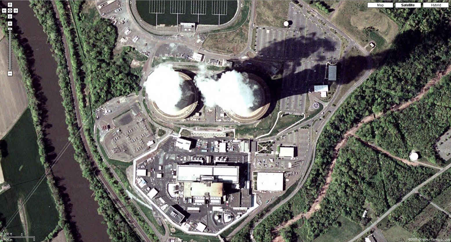
| Susquehanna Nuclear Power Station Berwick, Pennsylvania
41N 05' 31", 76W 08' 52" |
| http://maps.google.com/maps?f=q&hl=en&geocode=&time=&date=&ttype=&q=Berwick,+Pennsylvania&ie=UTF8&ll=41.091376,-76.145006&spn=0.006922,0.016994&t=k&z=17&iwloc=addr&om=0
|
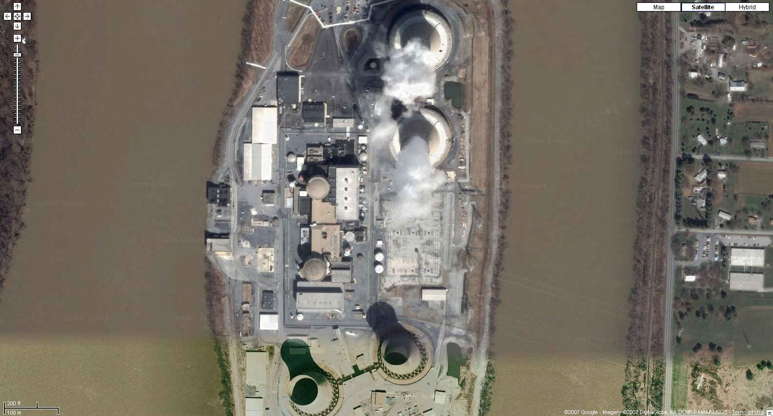
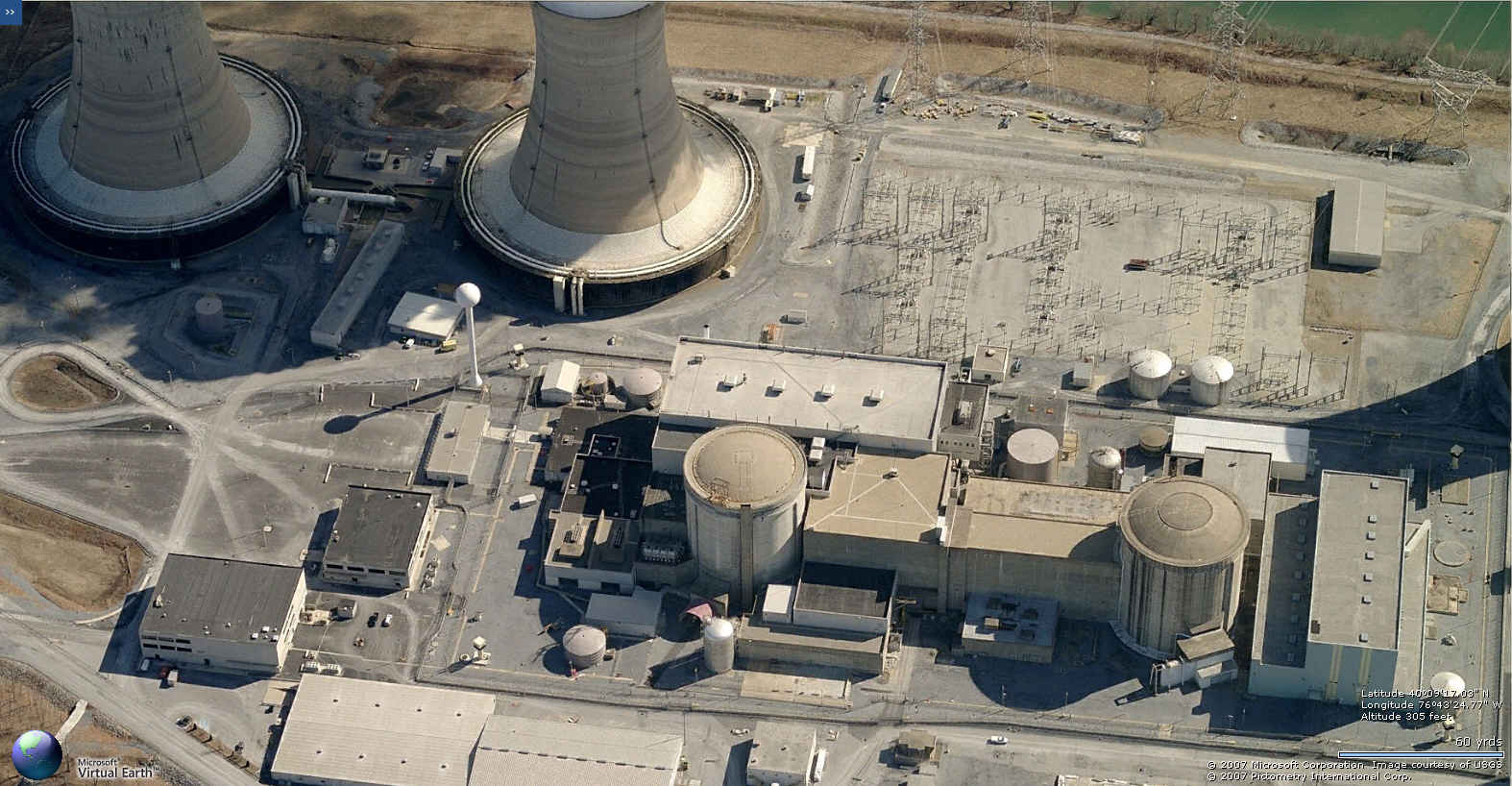
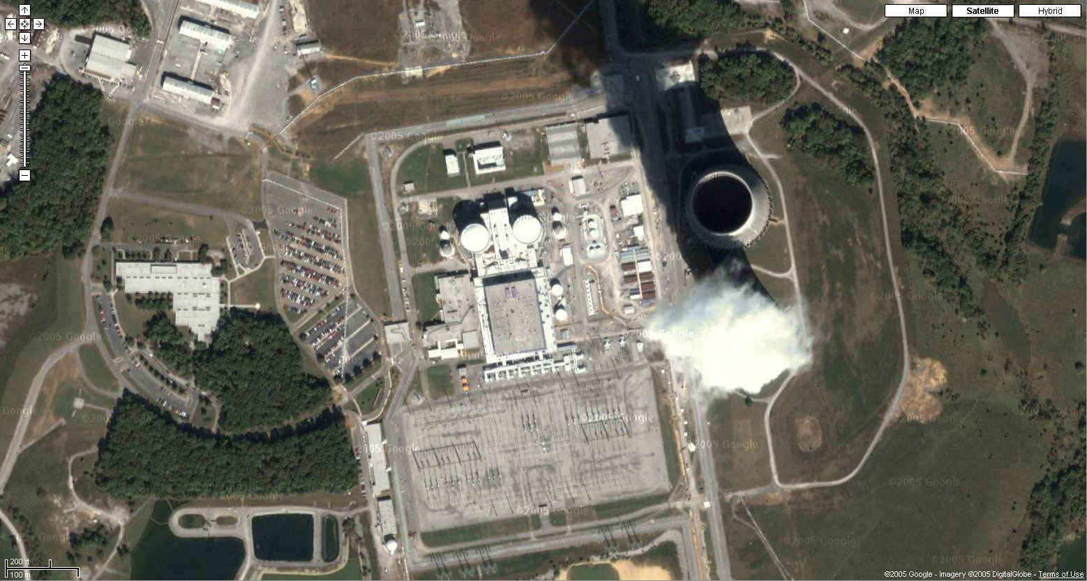
| Three Mile Island Nuclear Power Station Londonderry Township, Dauphin County, Pennsylvania
40N 09' 18", 76W 43' 25" |
| http://maps.google.com/maps?f=q&hl=en&geocode=&time=&date=&ttype=&q=falmouth,pa&ie=UTF8&ll=40.154244,-76.723752&spn=0.007028,0.016994&t=k&z=17&om=0
|
| Local Live
|
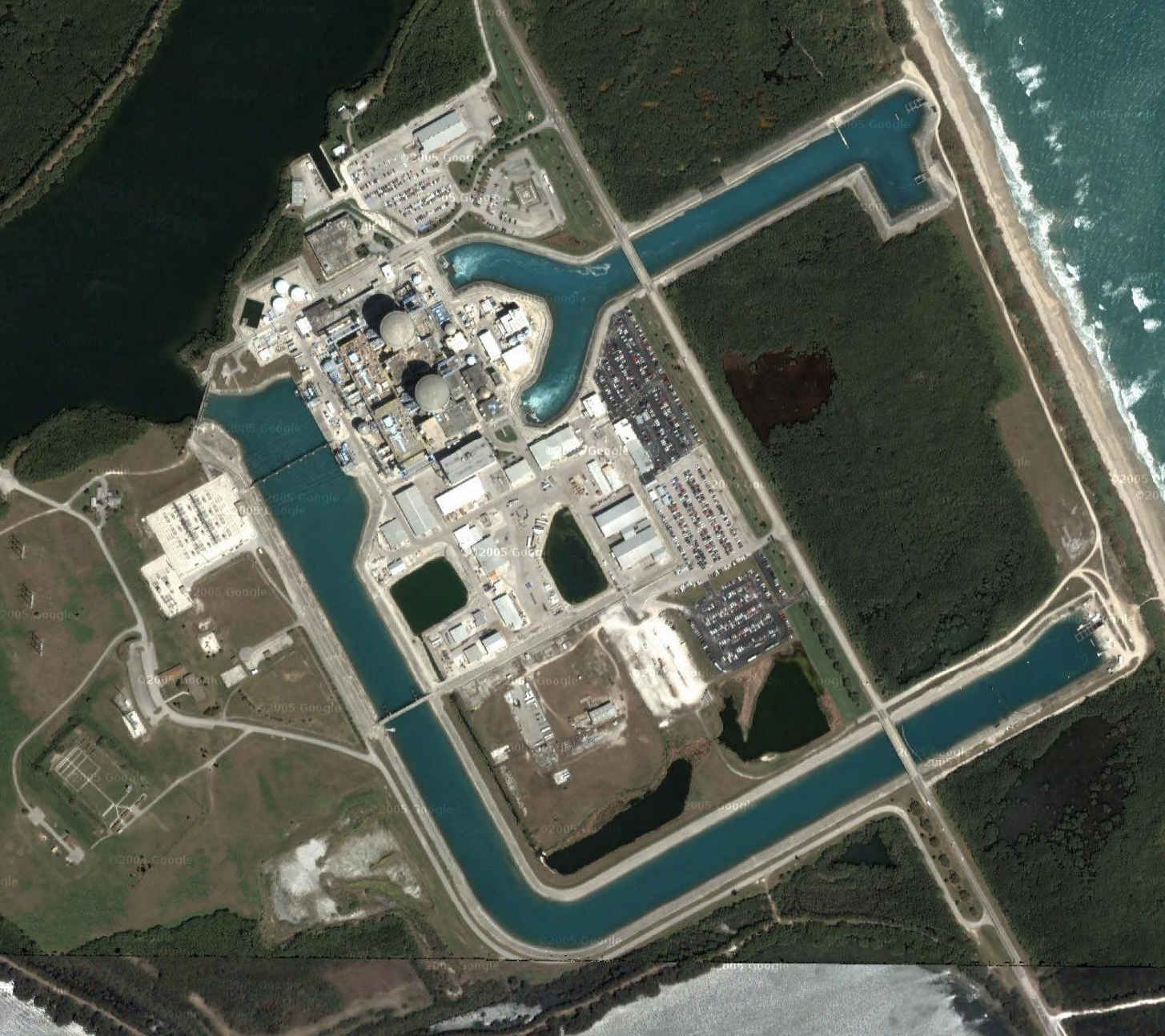
| Turkey Point Nuclear Power Plant Florida City, Dade County, Florida
25N 26' 03", 80W 19' 54" |
| Local Live
|
| Google
Maps Photo
|
| Vermont Yankee Nuclear Power Station Vernon, Vermont
42N 46' 43", 72W 30' 58" |
| http://maps.google.com/maps?f=q&hl=en&geocode=&time=&date=&ttype=&q=Vernon,+Vermont&ie=UTF8&ll=42.778827,-72.514293&spn=0.006749,0.016994&t=k&z=17&om=0
|
| Vogtle Nuclear Power Station Waynesboro, Georgia
33N 08' 28", 81W 45' 48" |
| http://maps.google.com/maps?f=q&hl=en&geocode=&time=&date=&ttype=&q=Waynesboro,+Georgia&ie=UTF8&ll=33.142726,-81.760565&spn=0.007699,0.016994&t=k&z=17&iwloc=addr&om=0
|
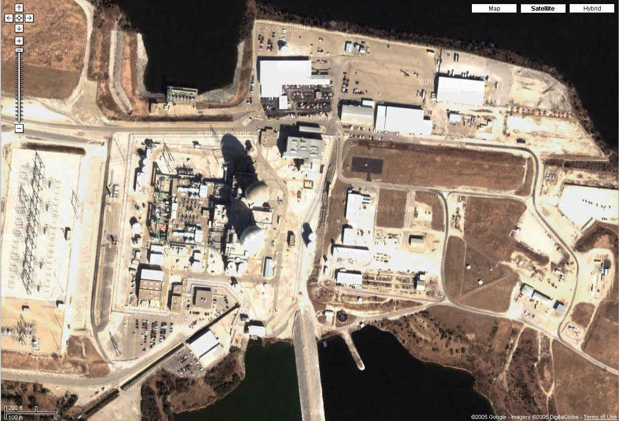
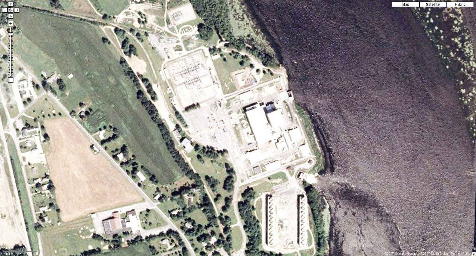
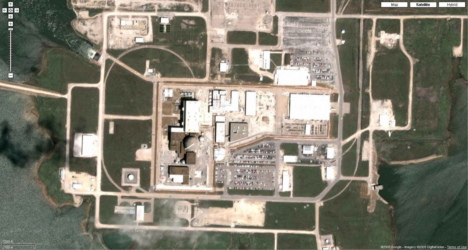
| Waterford 3 Steam Electric Station Killona, Louisiana
9N 59' 39", 90W 28' 30" |
| Local Live
|
| NOAA photo September 1, 2005, reduced to 25%. Full size photo: http://ngs.woc.noaa.gov/storms/katrina/24426275.jpg
|
| Watts Bar Nuclear Power Station Spring City, Tennessee
35N 36' 06", 84W 47' 32" |
| Google
Maps Photo
|
| Wolf Creek Generating Station Burlington, Kansas
38N 14' 15", 95W 41' 14" |
| Google
Maps Photo
|


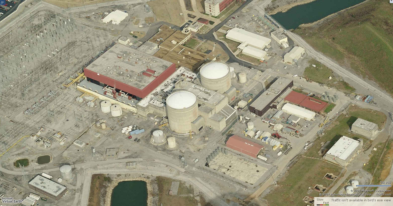
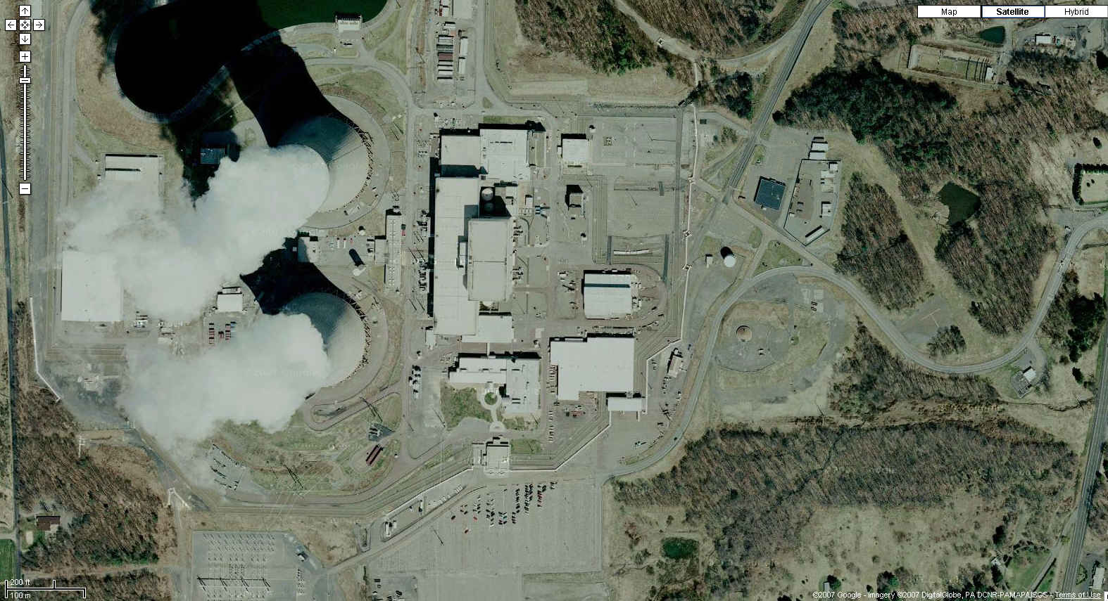
![[Image]](harris3.jpg)


